Home » Themes » Landscape » Exploration
Mount Bryan Summit CairnPrint Page 
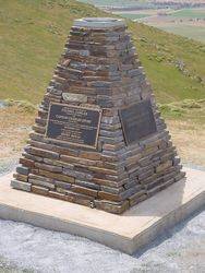
The cairn replaces the one erected by surveyor Edward Frome which was demolished by the South Australian Water Authority in 1970 to make way for other engineering works when Mount Bryan became a Water Reserve.
The first European to see the mountain now known as Mount Bryan was the explorer Edward John Eyre who explored the area in July 1839. It was next explored and climbed in December 1839, by Governor Gawler, Captain Charles Sturt and party which included the young man, Henry Bryan, in whose honour Gawler named the feature. In 1842, the Colonial Surveyor, Lieutenant Edward Frome further explored the area and erected a cairn on the site. Frome is also reputed to have been the first European to ascend to the actual summit. He later again visited the area, at which time he climbed to the summit and made a number of sketches
Location
| Address: | Mount Bryan Summit, Mount Bryan East , 5419 |
|---|---|
| State: | SA |
| Area: | AUS |
| GPS Coordinates: | Lat: -33.426944 Long: 138.972778 Note: GPS Coordinates are approximate. |
Details
| Monument Type: | Monument |
|---|---|
| Monument Theme: | Landscape |
| Sub-Theme: | Exploration |
Dedication
| Actual Monument Dedication Date: | Friday 6th December, 2002 |
|---|
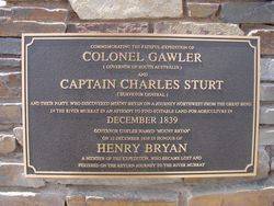
Commemorating The Fateful Expedition Of
COLONEL GAWLER
(Governor of South Australia)
And
CAPTAIN CHARLES STURT
(Surveyor General)
And Their Party, Who Discovered Mount Bryan On A Journey Northwest From The Great Bend In The River Murray In An Attempt To Find Suitable Land For Agriculture In
DECEMBER 1839
Governor Gawler Named `Mount Bryan`
On 12 December 1839 In Honour Of
HENRY BRYAN
A Member Of The Expedition, Who Became Lost And
Perished On The Return Journey To The River Murray
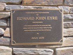
Commemorating The Expedition
Of
EDWARD JOHN EYRE
And His Party
The First Europeans To Explore The
Area West Of Hallett On A Trek To The
Northern Areas Of South Australia
In
JULY 1839
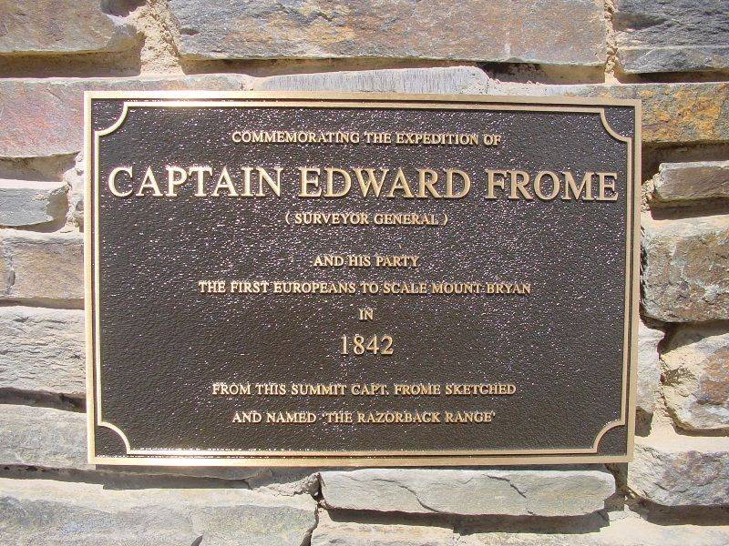
Commemorating The Expedition Of
CAPTAIN EDWARD FROME
(Surveyor General)
And His Party
The First Europeans To Scale Mount Bryan
In
1842
From This Summit Capt. Frome
Sketched And Named 'The Razorback Range`
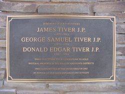
In Memory Of Our Forefathers
JAMES TIVER J.P.
(1829 - 1909)
GEORGE SAMUEL TIVER J.P.
(1873 - 1959)
DONALD EDGAR TIVER J.P.
(1903 - 1976)
Three Successive Tiver Generations To Hold
Pastoral Property In Hallett And Yunta Districts
This Cairn Erected By The Tiver Family In 2002
In Honour Of Our Early Explorers And Settlers


