Home » Themes » Technology » Industry
Historic Engineering Marker - Prospect DamPrint Page 
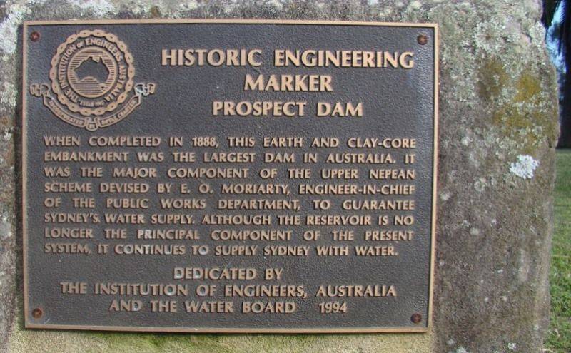
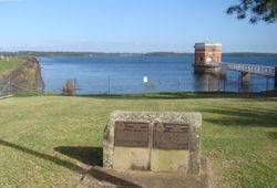
The plaque recognises Prospect Dam as an Historic Engineering Marker.
In 1867, the Governor of NSW appointed a Commission to recommend a scheme for Sydney's water supply, and by 1869 it was recommended that construction commence on the Upper Nepean Scheme. This consisted of two diversion weirs, located at Pheasant's Nest and Broughton's Pass, in the Upper Nepean River catchment, with water feeding into a series of tunnels, canals and aqueducts known as the Upper Canal. It was intended that water be fed by gravity from the catchment into a reservoir at Prospect. This scheme was to be Sydney's fourth water supply system, following the Tank Stream, Busby`s Bore and the Botany (Lachlan) Swamps.
Prospect Reservoir was the first earthfill embarkment dam in Australia and was completed in 1888. At the time it was intended to deliver water from the Upper Nepean Scheme via the Upper Canal to the reservoir. The quintessential feature of the scheme was the diversion of the Nepean River below its junction with the Avon and Cordeaux Rivers. The Pheasant's Nest weir, near the township of Wilton, diverts the water through a 7 km long tunnel to the Cataract River at Broughton's Pass, near the township of Appin, where a similar weir diverts the flow of the four rivers through a 58 km system of tunnels, aqueducts and open channels to Prospect Creek upon which the earthen dam wall is located. When it was completed in 1888, Prospect reservoir provided the storage component of the scheme, as the weirs did not have the capacity to store water. Prior to the completion of the Lower Canal, the water shortage still needed to be dealt with. Hudson Brothers of Clyde built a temporary raised pipe structure to deliver water from Prospect direct to the Botany Swamps.
The Institution of Engineers Australia, through its Heritage Committees, established the Australian Historic Engineering Plaquing Program to acknowledge past engineering achievements and to draw public attention to the significant contributions they have made to society.The Plaquing Program is a means of bringing public recognition to significant historic engineering works and the engineers who created them. The Program is intended to contribute to the conservation of Australian engineering heritage.
Location
| Address: | Reservoir Road, Prospect Reservoir, Prospect, 2148 |
|---|---|
| State: | NSW |
| Area: | AUS |
| GPS Coordinates: | Lat: -33.825131 Long: 150.909611 Note: GPS Coordinates are approximate. |
Details
| Monument Type: | Plaque |
|---|---|
| Monument Theme: | Technology |
| Sub-Theme: | Industry |
Dedication
| Approx. Monument Dedication Date: | 1994 |
|---|
HISTORIC ENGINEERING
MARKER
Prospect Dam
When Completed In 1888, This Earth And Clay-Core
Embankment Was The Largest Dam In Australia.
It Was The Major Component Of The Upper Nepean
Scheme Devised By E. O. Moriarty, Engineer-In-Chief
Of The Public Works Department, To Guarantee
Sydney`s Water Supply. Although The Reservoir Is No
Longer The Principal Component Of The Present
System, It Continues To Supply Sydney With Water.
Dedicated By
The Institution Of Engineers, Australia
And The Water Board 1994


