Home » Themes » People » Settlement
Henry HellyerPrint Page 
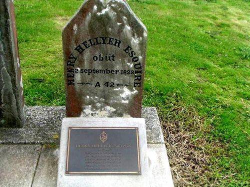
The Plaque on the grave recognises the pioneering work of Henry Hellyer, explorer and surveyor.
When the Van Dieman`s land Company was formed Hellyer was one of the first to sign on, utilising his skills to transform the land of north west Tasmania. He named Valentine`s Peak, designed the now-historic "Highfield House" in Stanley and, most importantly he made a road.
Hellyer wanted to link the remote inland settlements with the growing coastal town of Emu Bay, known today as Burnie. Local legend has it that with little more than a bullock gang and crude hand tools he carved his way through the dense forest into the wild hills. The road was a success and subsequently named after him
Location
| Address: | Browns Road, Cemetery, Stanley, 7331 |
|---|---|
| State: | TAS |
| Area: | AUS |
| GPS Coordinates: | Lat: -40.759432 Long: 145.298072 Note: GPS Coordinates are approximate. |
Details
| Monument Type: | Plaque |
|---|---|
| Monument Theme: | People |
| Sub-Theme: | Settlement |
| Link: | http://adbonline.anu.edu.au/adbonli… |
Dedication
HENRY HELLYER, Surveyor
1790 - 1832.
This plaque is in recognition of the
pioneering work of Henry Hellyer as
Surveyor, Explorer, Engineer and
Architect for the Van Diemen`s Land
Company in North West Tasmania
between the years 1827 to 1832.


