Home » Themes » People » Settlement
Henry HellyerPrint Page 
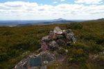
A cairn believed to be erected in 1831 by Henry Hellyer, has a plaque attached to it which commemorates his work as a surveyor with the Van Dieman`s Land Company. When Hellyer built the cairn, half of Tasmania (Van Diemen`s Land) west of the meridian that passes through Port Sorell was uninhabited by Europeans except for small settlements.
The cairn is the oldest intact piece of evidence of European colonisation in the western half of Tasmania.
Henry Hellyer (1790 – 1832) was an English surveyor and architect who was one of the first explorers to visit the rugged interior of the north west of Tasmania, Australia and made the most comprehensive maps of the area up to that time. When the Van Dieman`s Land Company was formed in 1825 he was one of the first officers to sign on, as a surveyor (later Chief Surveyor) and Chief Architect. His achievements in Tasmania are well documented, and the Court of Directors of the VDL Co in London noted his resignation (March 1832) as follows: "Mr Hellyer, whose valuable services have been so great and whose name is so well known both to the Colonial Government and at home, by his unwearied exertions for the company, by his personal privation and risk in exploring the country, and by the admirable maps and plans which have been exhibited, has been recently appointed to an important situation under the Surveyor-General of the Colony". Hellyer committed suicide in 1832.
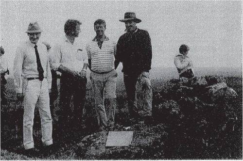
Note: The image from March 1989 shows from left Surveyor-General, Chris Rowe, Brian Rollins, John Medbury and Nick Griggs.
Location
| Address: | Belvoir Road, Mount Prospect, Black Buff Range, approximately 10 kilometres west of Middlesex, Middlesex, 7306 |
|---|---|
| State: | TAS |
| Area: | AUS |
| GPS Coordinates: | Lat: -41.5225 Long: 145.879722 Note: GPS Coordinates are approximate. |
Details
| Monument Type: | Monument |
|---|---|
| Monument Theme: | People |
| Sub-Theme: | Settlement |
| Approx. Event Start Date: | April-1831 |
| Approx. Event End Date: | July-1831 |
| Link: | http://www.dpipwe.tas.gov.au/inter.… |
Dedication
| Actual Monument Dedication Date: | Saturday 11th March, 1989 |
|---|
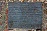
Henry Hellyer, Surveyor
1790 - 1832
This plaque was placed by the members of the Institution of Surveyors Australia to commemorate the work of Henry Hellyer in mapping the Van Diemens Land Company land grants.
The cairn is believed to have been erected by Hellyer in 1831.
It is one of the oldest survey monuments in Tasmania.
Unveiled by the surveyor General C. M. Rowe 11 March 1989.
Donated by Electrolytic Zinc Co. Ltd.


