Roger Knyvett DulhuntyPrint Page 
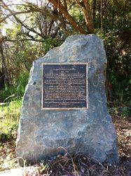
The monument commemorates Roger Knyvett Dulhunty who was a surveyor and the developer of many residential areas in Port Macquarie.
Location
| Address: | 331 Plomer Road , Limeburners Creek National Park, Port Macquarie, 2444 |
|---|---|
| State: | NSW |
| Area: | AUS |
| GPS Coordinates: | Lat: -31.394556 Long: 152.917299 Note: GPS Coordinates are approximate. |
Details
| Monument Type: | Monument |
|---|---|
| Monument Theme: | People |
| Sub-Theme: | Industry |
Dedication
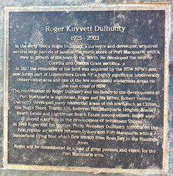
Roger Knyvett Dulhunty
1925 - 2003
In the early 1960`s Roger Dulhunty, a surveyor and developer, acquired several large parcels of land on the north shore of Port Macquarie with a view to the growth of the town to the north. He developed the nearby Coorilla and Queens Grant sections.
In 2017 the remainder of the land was acquired by the NSW NPWS and now forms part of Limeburners Creek NP a highly significant biodiversity conservation area and one of the few nominated wilderness areas on the east coast of NSW.
The contribution by Roger Dulhunty and his family to the development of Port Macquarie is significant. Roger and his father, Robert Venour Dulhunty, developed many residential areas of the town such as Clifton, the North Shore, Transit Hill, Bellevue Hill, Macquarie Heights, Shelley Beach Estate and Lighthouse Beach Estate among others. Roger also played a key role in the development of Settlement Shores.
In 1949 Roger and his brother Philip Wellesley Dulhunty, introduced the first regular air service between Sydney and Port Macquarie with a Sunderland flying boat which flew weekly from Rose Bay to the Hastings River.
Roger will be remembered as a man of great passion and vision for the Port Macquarie area.


