Home » Themes » People » Exploration
Edmund (Ted) ColsonPrint Page 
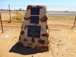
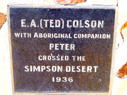
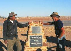
The cairn commemorates explorer and bushman, Edmund (Ted) Colson who first crossed the Simpson Desert in 1936.
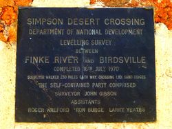
It also contains a plaque detailing a levelling survey between Finke River and Birdsville which was completed on the 16th July 1970.
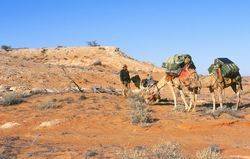
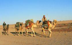
The triumph of Colson`s explorations was his crossing of the Simpson Desert, which had previously defeated Charles Sturt and David Lindsay. Prompted by an exceptionally wet season and accompanied only by young Eringa Peter of the Antakurinya tribe, Colson set out from Blood Creek on 26 May 1936. He led a train of five camels eastward along the 26th parallel, clambering over a thousand steep, red sand-ridges, and naming Alice Hills, Glen Joyce and Lake Tamblyn.
Navigating by compass, he reached his goal, Poeppel`s Corner, the point where the Queensland, Northern Territory and South Australian borders met. Ted and Peter walked into the Birdsville pub, Queensland, on 11 June. Three days later they headed back, nailing a tin plate—bearing the date and Colson`s initials—to the peg at Poeppel`s Corner.
Mr. E. A. (Ted) Colson, of Blood's Creek, 100 miles north of Oodnadatta, arrived at Birdsville on Thursday, having been the first white man to cross the vast stretch of country from there to Birdsville. Mr. Colson says that he set out from Mount Etingambra, 53 miles north of Blood's Creek, with five camels and a native on May 27 to cross the Simpson Desert. He set his course by compass and hit wthin a quarter of a mile of Birdsville, and then found his way along the border fence. Mr. Colson said that he was surprised to find vast areas of green feed and the camels got fat on the trip. There was ample evidence, however, that the country had undergone a terrific drought in the last few years.
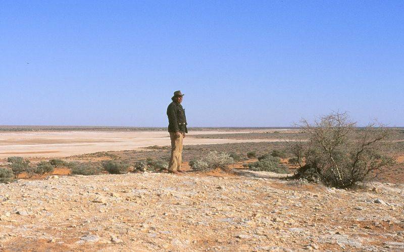
There were vast stretches of sandhills which made travelling most arduous and from the remains of spinifex grass which he found, it seemed that they had extended extensively during the past few years. The sandhills, he said were uniform in a direction of about 20 degrees off north and south and averaged six to the mile, two of which would be huge. Usually they had a gentle slope from the west with a top of drift sand falling steeply on the eastern side in a slope of about three in one. The camels, which were lightly loaded, sank knee deep in the sand. "The country has little of interest geologically.'' Mr. Colson said. 'There seems to be little possibility of settlement even in the best of seasons and it is doubtful if settlement of any sort is desirable as the eating of the vegetation would lead to further drift.
Advertiser (Adelaide), 18 June 1936.
Ted Colson had a part aboriginal son, Danny Colson, who at a very young age he had been forcibly taken from his mother and sent to Colebrook Home at Quorn in South Australia.
Danny and a girl travelling with him had jumped out of the back of the moving vehicle when it slowed for a creek crossing, and heading in different directions, had tried to escape. However he was re-captured. The policy of separation caused great grief and dislocation to many part aboriginal children when they were removed from their families and tribal ways. Danny had heard that his father was coming to Adelaide by vehicle and was overjoyed that he would finally get to meet him and perhaps be taken back to his mother and his homeland away to the north. Ted Colson however never made it. While driving he suffered a fatal heart attack and ran off the road.
Denis Bartell and Danny Colson, departed from Bloods Creek in 1994 and carried out a re-enactment of his father’s journey and after three weeks of desert travel arrived at the monument to Ted Colson and his aboriginal companion, Peter.
Location
| Address: | Adelaide & Burt Streets, Opposite Birdsville Hotel , Birdsville, 4482 |
|---|---|
| State: | QLD |
| Area: | AUS |
| GPS Coordinates: | Lat: -25.899221 Long: 139.351296 Note: GPS Coordinates are approximate. |
Details
| Monument Type: | Monument |
|---|---|
| Monument Theme: | People |
| Sub-Theme: | Exploration |
| Actual Event Start Date: | 24-May-1936 |
| Actual Event End Date: | 11-June-1936 |
| Link: | http://adbonline.anu.edu.au/adbonli… |
Dedication
| Approx. Monument Dedication Date: | September-1973 |
|---|
Plaque :
Simpson Desert Crossing
Department of National Development
Levelling survey between Finke River and Birdsville
Completed 16th July 1970
Surveyor walked 230 miles each way, crossing 1,101 sand ridges
The self contained party comprised
Surveyor John Gibson
Assistants Robert Wreford Ron Burge Larry Yeates
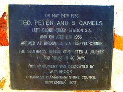
Plaque :
On May 24th 1936 Ted, Peter and five camels left Blood Creek Station S.A. and on June 11th 1936 arrived at Birdsville via Poeppel Corner
The southerly return completed a journey of 600 miles in 40 days
This monument was dedicated by W. F. Brook Chairman Diamantina Shire Council
September 1973
Plaque :
E.A. (Ted) Colson with Aboriginal companion Peter crossed the Simpson Desert
1936


