Home » Themes » People » Exploration
John McDouall StuartPrint Page 
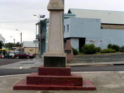
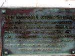
The plaque commemorates explorer John McDouall Stuart who reached Streaky Bay on the 22nd August 1858. The plaque is located on the Nuyts Obelisk.
In 1846 - 1858 Stuart practised as a surveyor, had an estate agency and spent some time at Port Lincoln. With financial help from William Finke, Stuart set out on 14 May 1858 with an assistant, an Aboriginal tracker and provisions for four weeks to explore beyond Lake Torrens and Lake Gairdner and to look for grazing land. He travelled as far as Coober Pedy before turning south and then west.
The Aboriginal left them on 3 August, and with supplies and water almost exhausted and the horses lame they struggled into T. M. Gibson's outstation at Streaky Bay on 22 August. After ten days rest Stuart returned to Adelaide to an enthusiastic welcome. He had discovered 103,600 square kilometres of possible sheep country at minimal cost.
He gave his diary and maps to the South Australian government and was granted a lease of 2590 square kilometres of the country.
Location
| Address: | Alfred Terrace & Bay Road, Streaky Bay, 5680 |
|---|---|
| State: | SA |
| Area: | AUS |
| GPS Coordinates: | Lat: -32.795995 Long: 134.211135 Note: GPS Coordinates are approximate. |
Details
| Monument Type: | Plaque |
|---|---|
| Monument Theme: | People |
| Sub-Theme: | Exploration |
| Actual Event Start Date: | 22-August-1858 |
| Actual Event End Date: | 22-August-1858 |
| Link: | http://adbonline.anu.edu.au/adbonli… |
Dedication
| Actual Monument Dedication Date: | Friday 22nd August, 1958 |
|---|
John McDouall Stuart (1815 - 1864) on his expedition west of Lake Torrens reached Streaky Bay 22nd August 1858.
In later expeditions he discovered and named the MacDonnell Ranges (1860) and was the first to cross Australia from south to north through the "Centre" (1862).
Unveiled 22nd August 1958


