Home » Themes » People » Exploration
Captain Collet BarkerPrint Page 
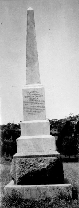
The monument commemorates explorer, Captain Collet Barker (1784 - 1831).
Mount Barker, the mountain, was first sighted by Captain Charles Sturt in 1830. Sturt named the mountain in honour of Captain Barker after he was killed later that year by Aborigines, at the Murray Mouth.
Collet Barker (1784 – 1831) was a British military officer and explorer. He explored areas of South Australia, Western Australia and Cobourg Peninsula, Northern Territory.
When Charles Sturt returned after his exploration of the Murray in 1830 he recommended that the coast at the head of St Vincent's Gulf should be examined to ascertain whether another channel from the Murray entered the sea there and suggested that Barker would be a suitable man for this work. Governor Darling agreed, and on 13 April 1831 Barker, with a small party, arrived at Cape Jervis on the ship Isabella.
He examined the coast on the eastern side of the gulf for over 60 miles and found that there was no channel. With four companions he made his way to the ranges, ascended Mount Lofty, and definitely fixed its geographical position. He rejoined the remainder of his companions on 21 April, and six days later with a small party left the ship at a point about 12 miles north of Cape Jervis, and went overland to trace the connexion between Lake Alexandrina and Encounter Bay. On 30 April an outlet to the sea was reached, which was comparatively narrow, and Barker swam across, went over a sandhill, and was never seen again. His companions watched from their side of the water until next day and then went back to their ship. A few days later it was learned through friendly aborigines that Barker had been speared and his body thrown into the sea, Sturt considered that he had suffered for the sins of white sealers against the blacks.
The unveiling of the Captain Barker memorial recently erected by the residents of Mount Barker took place on Wednesday afternoon, 21st January 1903. There was a large attendance, including members of the district council and committee, Mr. C. Bom (who erected the monument), Mr. T. Coward (Adelaide), and members of the South Australian branch of the Royal Geographical Society of Australasia, who drove up from Adelaide.
The site granted by the district council at the eastern end of Druids Avenue, on the main road to Nairne, was the most conspicuous available, and the monument can he seen from Gawler Street, the Adelaide Road, and the railway line.
The Mount Barker Courier and Onkaparinga and Gumeracha Advertiser (SA), 22 May 1903.
Location
| Address: | Wellington Road & Maldon Street, Mount Barker, 5251 |
|---|---|
| State: | SA |
| Area: | AUS |
| GPS Coordinates: | Lat: -35.074381 Long: 138.858891 Note: GPS Coordinates are approximate. |
Details
| Monument Type: | Monument |
|---|---|
| Monument Theme: | People |
| Sub-Theme: | Exploration |
Dedication
| Actual Monument Dedication Date: | Wednesday 21st January, 1903 |
|---|
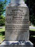
Erected to the memory of Captain Collett Barker of H.M. 39th Regiment of Foot who discovered the District and Mount which bears his name.
He was killed by the Blacks on the 30th April 1831 while endeavouring to ascertain the communication between Lake Alexandrina and Encounter Bay


