Home » Themes » People » Exploration
Major Thomas Mitchell Print Page 
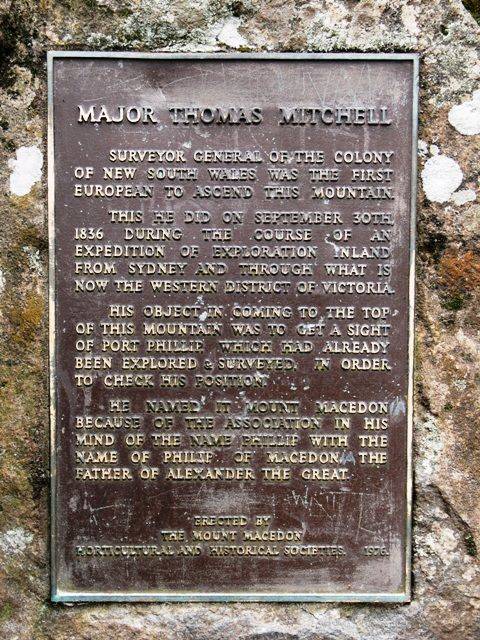
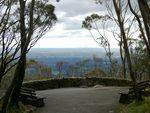
The plaque commemorates the explorer Major Thomas Mitchell and his explorations in Australia Felix, and the climbing and naming of Mount Macedon. The plaque erected in his honour was unveiled in 1976 at the lookout. This lookout, named after Major Mitchell, looks out towards the west across the Wombat State Forest and to the southern part of Woodend.
Major Thomas Mitchell, Surveyor General of the Colony of New South Wales; was the first person to map and survey Mount Macedon, naming the Mountain after Philip of Macedon, father of Alexander the Great. He did this on September 30th, 1836.
Location
| Address: | Cameron Drive, Major Mitchell Lookout, Memorial Cross Reserve, Macedon Regional Park, Mount Macedon, 3441 |
|---|---|
| State: | VIC |
| Area: | AUS |
| GPS Coordinates: | Lat: -37.388794 Long: 144.576511 Note: GPS Coordinates are approximate. |
Details
| Monument Type: | Plaque |
|---|---|
| Monument Theme: | People |
| Sub-Theme: | Exploration |
Dedication
| Approx. Monument Dedication Date: | 1976 |
|---|
Major Thomas Mitchell
Surveyor General of the Colony of New South Wales was the first European to ascend this mountain.
This he did on September 30th, 1836 during the course of an expedition of exploration inland from Sydney and through what is now the Western District of Victoria.
His object in coming to the top of this mountain was to get a sight of Port Phillip, which had already been explored & surveyed in order to check his position.
He named it Mount Macedon because of the association in his mind of the name Phillip with the name of Philip of Macedon the father of Alexander the Great.
Erected by the Mount Macedon Horticultural and Historical Societies.
1976


