Home » Themes » People » Exploration
Hume & HovellPrint Page 

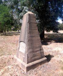
The cairn commemorates the explorers Hume and Hovell who passed through the area on their return journey in 1824. The cairn was unveiled in 1924, the centenary year of their exploration.
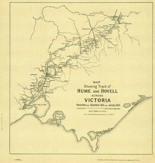
In 1824 Hamilton Hume and William Hilton Hovell, encouraged by Governor Brisbane, led an expedition of six convict servants overland to reach the Southern coast. A fortnight after leaving Hume's home at Appin, the party left his station at Gunning, on October 17th 1824, with five bullocks, three horses and two carts.
They were the first Europeans known to see what is called the Murray River. They named it the Hume River for Hamilton Hume's father. However in 1830 Captain Charles Sturt, not realising he was the same river Hume and Hovell had encountered upstream, named the Murray River in honour of the then British Secretary of State for War and the Colonies, Sir George Murray. Arriving at the river, Hume & Hovell each carved their name into separate trees. Hamilton Hume's tree was burnt down in fires in the 1840s. William Hovell's tree survives to date, despite a termite attack, and in 2013 a clone of it was planted in Tatong. Hume & Hovell arrived at Corio Bay on December 16th 1824. Hovell had miscalculated at the end, and they thought they were at Westernport.
Monuments, cairns or plaques commemorating this expedition were erected at Allan`s Flat, Avenel, Back Creek, Barjarg, Bellbridge, Broadford, Bulla, Deer Park, Ebden, Euroa, Everton, Hansonville, Hume Reservoir, Kilmore, Lara, Lima South, Meadow Creek, Molyullah, Mount Buffalo, Moyhu, Murmungee, Myrtleford, Samaria, Samaria West, Seymour, Staghorn Flat, St Albans, Stanley, Strath Creek, Swanpool, Tatong (Dodd`s Crossing), Violet Town, Warrenbayne West, Werribee, Whorouly, Woodfield Yarck and Yea.
The location of the plaques erected at Lima South is unknown. It is believed that the plaque at Hansonville has come from another location as the date on the plaque does not match the date that the expedition was there.
Location
| Address: | Centre Road, Molyullah, 3673 |
|---|---|
| State: | VIC |
| Area: | AUS |
| GPS Coordinates: | Lat: -36.642128 Long: 146.154607 Note: GPS Coordinates are approximate. |
Details
| Monument Type: | Monument |
|---|---|
| Monument Theme: | People |
| Sub-Theme: | Exploration |
| Actual Event Start Date: | 30-December-1824 |
| Actual Event End Date: | 30-December-1824 |
| Link: | https://www.sl.nsw.gov.au/stories/h… |
Dedication
| Actual Monument Dedication Date: | Wednesday 19th November, 1924 |
|---|
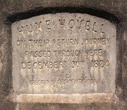
Hume & Hovell on their return journey passed through here
December 30th 1824.
Erected by residents 1924


 Hume and Hovell Centenary 1924
