Home » Themes » People » Exploration
Major Thomas Mitchell Print Page 
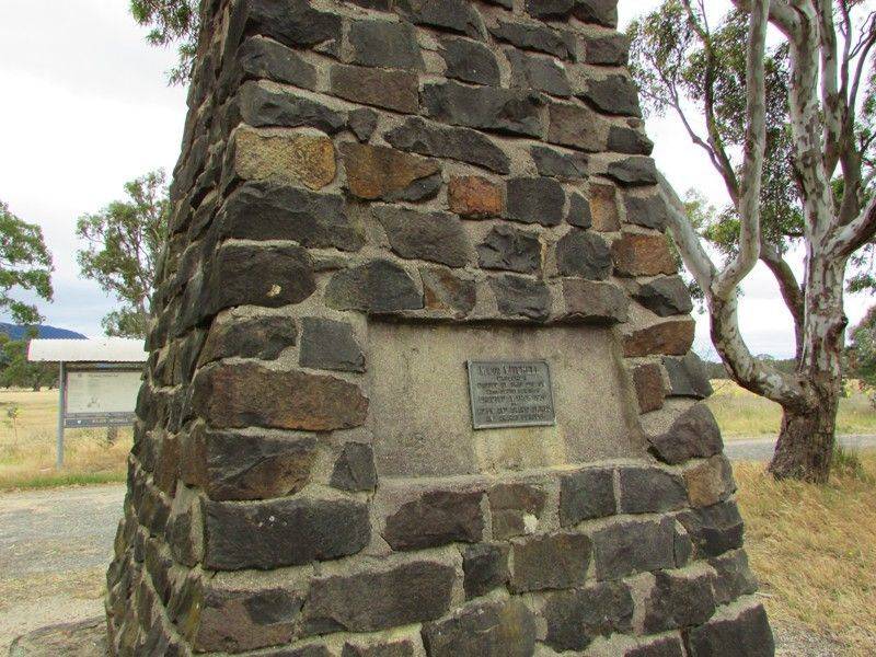
The cairn commemorates the exploration of Major Thomas Mitchell in 1836. This cairn was erected marking the homeward route.
At the unveiling of the Bulla memorial for Hume and Hovell, Charles Daley the Secretary of the Victorian Historical Society suggested that the idea be extended to to other explorers and a committee was formed to mark out the routes of Charles Sturt, Thomas Mitchell, Angus McMillan, and Count Paul de Strzelecki.
Thirty-six cairns or tablets to Mitchell were erected at Nyah West, Swan Hill, Cohuna, Mount Pyramid, Fernihurst, Wedderburn, Kanya, Stawell, Mount William, Horsham, Mount Arapiles, Miga Lake, Harrow, Coleraine, Casterton, Dartmoor, Isle of Bags, Portland, Mount Rouse, Mount Napier, Hamilton, Lake Repose, Dunkeld, Middle Creek, Mount Greenock, Skipton, Mitchellstown, Nagambie, Castlemaine, Expedition Pass, Kyneton, Benalla, Wangaratta, Chiltern, Gooramadda and a public park at Natimuk (Major Mitchell Park, Mount Arapiles, Natimuk).
Sir Thomas Livingstone Mitchell (1792 - 1855), surveyor and explorer of south-eastern Australia , was born at Grangemouth in Stirlingshire, Scotland. In 1827 he took up an appointment as Assistant Surveyor General of New South Wales. The following year he became Surveyor General and remained in this position until his death. Mitchell was knighted in 1839 for his contribution to the surveying of Australia.
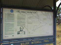
On his third expedition in 1836, Mitchell travelled to where the Lachlan, Murrumbidgee and Darling Rivers joined the Murray River in what is now Victoria. He mapped the western part of Victoria and named the Grampian Mountains, on the other side of which he found rich grazing land. The expedition travelled south west, and crossed mountains and rivers that no white people had ever seen. They reached the Glenelg River and rowed down to the sea at Portland Bay. Here Mitchell was surprised to find the Henty brothers and a thriving community that had been settled there since 1834.
Representatives of the Ararat Shire and Borough Councils and the Ripon Shire Council at a conference here discussed the proposal to commemorate the passing of Major Mitchell, the explorer through this district in 1836. It was decided to join in erecting a cairn about 16ft high near Buangor, at a point where Major Mitchell’s track crossed the Western Highway, and also to place a memorial tablet on the cairn at the summit of Mount William, in the Grampians which the explorer climbed during his 1836 journey.
The Argus (Melbourne), 3 October 1929.
Middle Creek, Sunday - Another erection on the path of Sir Thomas Mitchell`s exploration of 1836 was unveiled in the Western District yesterday was unveiled by Sir James Barrett, president of the Historical Memorials Committee. The memorial which was erected by the Shire of Ripon and Ararat and the borough of Ararat stands in a conspicuous position on the side of the Princes Highway, within a short distance of Middle Creek.
Argus (Melbourne), 31 March 1930.
Location
| Address: | Western Highway, 8 kilometres east of Buangor, Middle Creek , 3375 |
|---|---|
| State: | VIC |
| Area: | AUS |
| GPS Coordinates: | Lat: -37.389999 Long: 143.256713 Note: GPS Coordinates are approximate. |
Details
| Monument Type: | Monument |
|---|---|
| Monument Theme: | People |
| Sub-Theme: | Exploration |
| Actual Event Start Date: | 23-September-1836 |
| Actual Event End Date: | 23-September-1836 |
Dedication
| Actual Monument Dedication Date: | Sunday 30th March, 1930 |
|---|
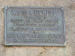
Major Mitchell explorer passed by this site on 23rd September 1836
Erected March 1930 by Ripon and Ararat Shires and Ararat Borough


