Home » Themes » Landscape » Settlement
Year of the Volunteer & 100 Years of FederationPrint Page 
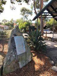
The monument commemorates the Year of the Volunteer held in 2001 and 100 years of the Federation of Australia.
Location
| Address: | Kenthurst Road & Nelson Street, John Benyon Rotary Park, Kenthurst, 2156 |
|---|---|
| State: | NSW |
| Area: | AUS |
| GPS Coordinates: | Lat: -33.661338 Long: 151.005641 Note: GPS Coordinates are approximate. |
Details
| Monument Type: | Monument |
|---|---|
| Monument Theme: | Landscape |
| Sub-Theme: | Settlement |
Dedication
| Approx. Monument Dedication Date: | 2001 |
|---|
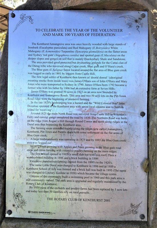
To celebrate the Year of the Volunteer and mark 100 years of Federation
The Kenthurst / Annangrove area was once heavily wooded with Ironbark (Eucalyptus paniculata) and Red Mahogany (E. botryoides) White Mahogany (E. acmeniodes) Turpentine (Syncarpia glomulifera) on the flatter areas and Sydney `Red Gum` (Angophora costata) and Spotted Gum (E. maculata) on the deeper slopes and gorges on soil that is mainly Hawkesbury shale and sandstone. The area provided good protected by dry hunting grounds for the Cattai clan of the Darug tribe who traversed along Cattai Creek, Blue Gum and O`Hara`s Creek. The Blue Gum (E. saligna) forest located around the flat area of Blue Gum Creek was logged as early as 1801 by loggers from Castle Hill. The first legal settler of Kenthurst then know as `dooral dooral` (Aboriginal meaning smoke inside trees) was James O`Hara son of John O`Hara and Mary Jones who were transported to Sydney in 1790. James O`Hara born 1792 became a farmer who with his father in 1806 had an extensive farm at Seven Hills. James O`Hara was granted 50 acres in 1823 on an area now bounded by Kenthurst and Annangrove Roads. This area and two 50 acre lots on Pitt Town Road ridge were the beginning of intensive farming.
In the late 1820`s bushranging was a hazard and the "Wild Colonial Boy" John Donahue operated in the Kenthurst area with several local citizens sent to Norfolk Island for `receiving`. Around 1825 the main North Road was surveyed from Castle Hill to Wiseman`s Ferry and convict gangs completed the road by 1830. The Northern Road was built on the ridge from Rogan`s Hill through Round Corner and north along ridges in the Dural area thus bypassing the Kenthurst area. The farming areas extended mainly along the ridges now called Annangrove, Kenthurst, Pitt Town and Porters roads with some settlement on the flat areas of Blue Gum Creek. A large timber industry was operating in 1875 and by 1885 the Blue Gum Creek around was `logged out`. In 1872 fruit growing with apples and pears growing in Blue Gum Road areas and citrus farming with extensive poultry farming on the main ridges. The first school opened in 1883 (a small slab hut with iron roof) then a weatherboard building in 1886 and a brick building in 1899. Extensive passionfruit farming existed from the 1890`s to the 1920`. The name Little Dural was changed to Kenthurst in 1886 and in 1889 a Kenthurst School of Arts was formed and a brick hall was built in 1895 ( the name was changed to Literary Institute in 1938) which became the village centre.


