www.monumentaustralia.org.au
Home » Themes » Landscape » Exploration
Crossing of the Logan RiverPrint Page 
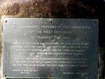
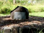
The plaque commemorates the crossing of the Logan River by the first European explorers to the area.
In August 1826, Patrick Logan set out in a whaleboat rowed by a crew of eight, accompanied by “one other gentleman.” They rowed into Moreton Bay, then continued south across Redland Bay on the inside of Stradbroke Island. At that time, this was one single island - the passage between north and south did not break through until 1896. Ahead was a somewhat confusing group of islands and channels including Coochiemudlo, Macleay and Russell. Logan appears to have followed his intuition and was rewarded when he realised the boat had reached the mouth of a large river. He followed the river inland, finding it about 2 metres to 6 metres deep for what he estimated as 120 kilometres, although it was probably less. The river then became more shallow, and several large gum trees which had fallen across the stream stopped the boats going further. Logan, with a characteristic persistence, followed the river a further 15 kilometres on foot, noting that it still seemed deep enough for a large boat. He also thought the surrounding country was “the finest tract of land I have seen in this or any other country.” In honour of the Governor, Logan named his discovery the Darling River. However the Governor changed the name and in 1827, announced that it was to be called the Logan in recognition of Patrick Logan’s zeal as Commandant at Moreton Bay.
View Google Map
In August 1826, Patrick Logan set out in a whaleboat rowed by a crew of eight, accompanied by “one other gentleman.” They rowed into Moreton Bay, then continued south across Redland Bay on the inside of Stradbroke Island. At that time, this was one single island - the passage between north and south did not break through until 1896. Ahead was a somewhat confusing group of islands and channels including Coochiemudlo, Macleay and Russell. Logan appears to have followed his intuition and was rewarded when he realised the boat had reached the mouth of a large river. He followed the river inland, finding it about 2 metres to 6 metres deep for what he estimated as 120 kilometres, although it was probably less. The river then became more shallow, and several large gum trees which had fallen across the stream stopped the boats going further. Logan, with a characteristic persistence, followed the river a further 15 kilometres on foot, noting that it still seemed deep enough for a large boat. He also thought the surrounding country was “the finest tract of land I have seen in this or any other country.” In honour of the Governor, Logan named his discovery the Darling River. However the Governor changed the name and in 1827, announced that it was to be called the Logan in recognition of Patrick Logan’s zeal as Commandant at Moreton Bay.
Location
| Address: | Mount Lindesay Highway, Tully Memorial Park, North Maclean, 4280 |
|---|---|
| State: | QLD |
| Area: | AUS |
| GPS Coordinates: | Lat: -27.784599 Long: 153.011521 Note: GPS Coordinates are approximate. |
Details
| Monument Type: | Plaque |
|---|---|
| Monument Theme: | Landscape |
| Sub-Theme: | Exploration |
Dedication
| Actual Monument Dedication Date: | Sunday 23rd July, 1978 |
|---|
Front Inscription
Source: MATO COMMEMORATE CROSSING OF THE LOGAN RIVER
BY THE FIRST EXPLORERS
TO TRAVERSE THIS AREA.
Captain Patrick Logan Who Discovered The River Mouth In 1826 Crossed Near This Point In July 1827 To Reach Brisbane After Finding The Fassifern Valley And The Logan Head Waters At Mt. Barney On A Walking Expedition From Ipswich.
July 1828 Explorers, Logan Cunningham, Fraser Crossed Near The Same Place And Followed The Logan River Upstream. On This Trip Logan Became The First Man To Climb Mt. Barney
Donated By Douglas Jolly
July, 1978 Beaudesert Shire Council
Monument details supplied by Monument Australia - www.monumentaustralia.org.au


