Home » Themes » Landscape » Exploration
Matthew Flinders ExpeditionPrint Page 
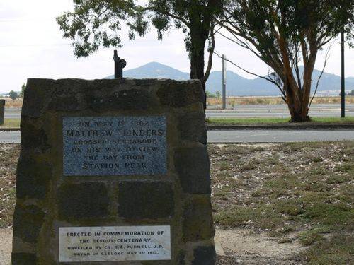
The cairn with an arrow marks the route of Matthew Flinders took on his way to the You Yangs.
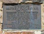
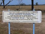
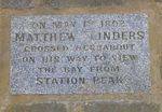
The tablet on the cairn marks the relocation of the cairn on the 22nd March in 1974 at the Bi-centenary of Flinders birth. A timber sign near the memorial indicates Flinders made the first survey of the district from Station Peak.
Location
| Address: | Princes Highway, Little River, 3211 |
|---|---|
| State: | VIC |
| Area: | AUS |
| GPS Coordinates: | Lat: -38.001772 Long: 144.494358 Note: GPS Coordinates are approximate. |
Details
| Monument Type: | Monument |
|---|---|
| Monument Theme: | Landscape |
| Sub-Theme: | Exploration |
| Actual Event Start Date: | 30-April-1802 |
| Actual Event End Date: | 1-May-1802 |
Dedication
| Actual Monument Dedication Date: | Thursday 1st May, 1952 |
|---|
On 30 April, 1802 Matthew Flinders, R.N. (1774 - 1814) Commander of H.M.S. Investigator crossed by boat grom Point Richards and camped ten or twelve furlongs west of Kirk`s Point.
The next day with three of his men he tramped along this line to & from the You Yangs.
On 22 March, 1974 this tablet was unveiled by the Chairman of the Country Roads Board, R. E. V. Donaldson Esq.
To mark the relocation of this cairn at the Flinders Bi-Centenary
Plaque:
On May 1st 1802 Matthew Flinders crossed hereabout on his way to view the bay from Station Peak
Plaque:
Erected in commemoration of the Sesqui-Centenary.
Unveiled by Cr. B. E. Purnell J. P. Mayor of Geelong
May 1st 1952
This cairn commemorates the fact that Captain Matthew Flinders R.N. made the first survey of this district from the summit of the You Yangs, which he named Station Peak.
The arrow shows his party`s line of march from the Bay.


