Home » Themes » Landscape » Exploration
Evans Survey Marker (Footsteps in Time)Print Page 
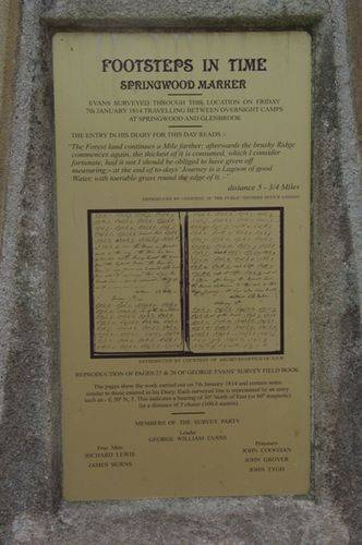
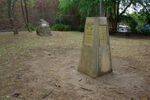
The Evans Survey Marker was installed as part of the Footsteps in Time Bicentenary Project in 1988 to commemorate the remarking of the first survey over the Blue Mountains by explorer and surveyor, George William Evans. The markers have since been restored.
There are fifteen, mostly unseen pillars or obelisks that re-mark the original 1813-14 survey by surveyor, George Evans who followed close behind the explorers Blaxland, Lawson & Wentworth & their 1813 Blue Mountains Crossing. In July, 1814 a party of men led by William Cox commenced building the road from Daniel Woodriff's farm at Penrith to Bathurst. Governor Macquarie travelled to Bathurst on the new 100 mile long road in April 1815.
George William Evans (5 January 1780 – 16 October 1852) was a surveyor and early explorer in the colony of New South Wales. On 13 November 1813 Governor Lachlan Macquarie sent Evans across the Blue Mountains into the Wiradjuri nation of central-western New South Wales to confirm the findings of the exploration party of Blaxland, Lawson, and Wentworth. He was the first European to record meeting with the Wiradjuri people of the region.
Evans generally followed the route of Blaxland, Lawson and Wentworth, reaching the end of their route on 26 November 1813 at a point Evans named Mount Blaxland. Evan's party then moved on and discovered the Fish River area and further west near the junction of the now named Fish and Campbell Rivers and described two plains in his view, the O'Connell Plains and the Macquarie Plains. It was on 9 December that he reached the site of present day Bathurst.
Location
| Address: | Macquarie Road, Springwood, 2777 |
|---|---|
| State: | NSW |
| Area: | AUS |
| GPS Coordinates: | Lat: -33.698827 Long: 150.566718 Note: GPS Coordinates are approximate. |
Details
| Monument Type: | Monument |
|---|---|
| Monument Theme: | Landscape |
| Sub-Theme: | Exploration |
| Approx. Event Start Date: | December-1813 |
| Approx. Event End Date: | January-1814 |
| Link: | http://adb.anu.edu.au/ |
Dedication
| Approx. Monument Dedication Date: | 1988 |
|---|
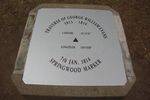
Traverse Of George William Evans
1813 -1814
Latitude -33'41'45"
Longitude 150'34'00"
7th JAN 1814
SPRINGWOOD MARKER
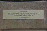
Plaque :
Unveiled By
His Excellency, Sir David Martin KCMG AO
(Governor of New South Wales)
on 26th April 1990
Plaque :
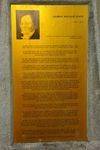
Footsteps
In
Time
The Re-Marking Of
The First Survey
Over The Blue Mountains
By
GEORGE WILLIAM EVANS
December 1813 - January 1814
This Monument Is Placed As Close To The Location
Of Evan`s Surveyed Line As Can Be Calculated From
His Original Field Book
It Is Identical To The Base Of A Trigonometrical
Survey Pillar, Currently Used Throughout N.S.W.
For Major Surveys, Of Which Evan`s Work Was A
Forerunner
The "Footsteps in Time" Project was initiated by John Yeaman B.E.M. and carried out by The Blue Mountains City Council & The N.S.W. Department of Lands with funding by The Australian Bicentennial Authority to celebrate Australia`s Bicentenary in 1988


