Burke & Wills ExpeditionPrint Page 
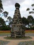
The scoria and bluestone obelisk marks the starting point for the Burke and Wills expedition in 1860.
On 20 August 1860, some 15,000 Melburnians gathered at Royal Park to farewell the 18 members of the Victorian Exploring Expedition, led by Robert O’Hara Burke. A fence was placed around a tree near their departure point in 1861. In 1890, the fence was removed and the cairn was erected about 180 metres east of the tree.
The Burke & Wills expedition involved 19 men aided by camels and cameleers with the intention of crossing Australia from Melbourne in the south to the Gulf of Carpentaria in the north, a distance of around 3,250 kilometres. At the time most of the inland of Australia had not be explored by non-indigenous people and was completely unknown to European settlers.
On 16 December 1860, Burke, Wills, Charles Gray and John King left Cooper Creek to make a dash for the northern shoreline. Burke and Wills eventually encountered salty marshes and a shifting tide, and could proceed no further. They had reached their goal, even though they could not see the open water.
The return journey proved fatal. Charles Gray died and the others limped back to the Cooper Creek camp only to find that rest of the depot party had departed just hours earlier. Burke and Wills died attempting to reach Mount Hopeless. King, near death, was cared for by the Yandruwandha people until a relief expedition rescued him.
When news of their disappearance reached Melbourne, four relief parties were despatched to search for them. One of the parties, led by Alfred Howitt, rescued King and buried Wills and Burke at Cooper Creek. In 1862, Howitt returned to Cooper Creek and retrieved the remains of Burke and Wills. They lay in state at the Royal Society of Victoria in Melbourne and were viewed by over 100,000 people. Some estimated that three-quarters of the city’s population watched the funeral procession in January 1863.
Location
| Address: | Macarthur Road, Royal Park, Parkville, 3052 |
|---|---|
| State: | VIC |
| Area: | AUS |
| GPS Coordinates: | Lat: -37.788944 Long: 144.956067 Note: GPS Coordinates are approximate. |
Details
| Monument Type: | Monument |
|---|---|
| Monument Theme: | Landscape |
| Sub-Theme: | Exploration |
| Actual Event Start Date: | 20-August-1860 |
| Actual Event End Date: | 20-August-1860 |
Dedication
| Approx. Monument Dedication Date: | 1890 |
|---|
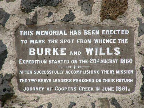
This Memorial Has Been Erected
To Mark The Spot From Whence The
BURKE And WILLS
Expedition Started On The 20th August 1860.
After Successfully Accomplishing Their Mission
The Two Brave Leaders Perished On Their Return
Journey At Coopers Creek In June 1861.


