Mitchell Shire Community Bushfire Memorial - BroadfordPrint Page 
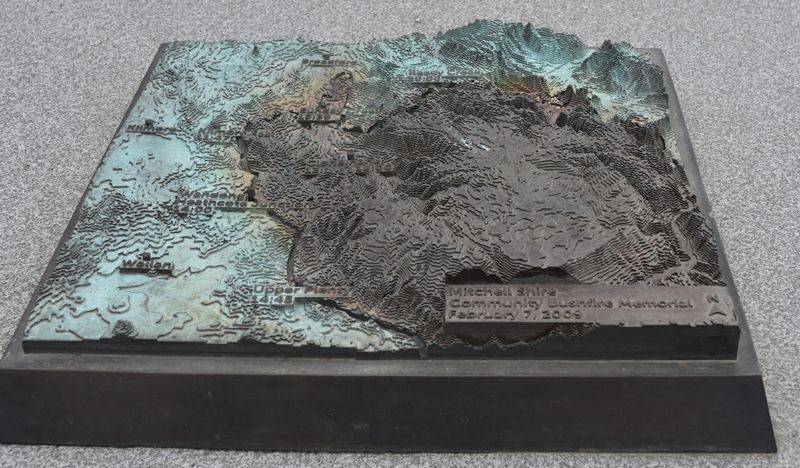
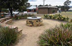
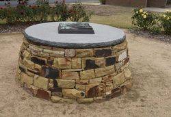
The stone seating wall and a monument was erected to commemorate the 2009 Black Saturday Fires. A plaque displays a map of the region and the time that the fire reached each town.
The 2009 Black Saturday bushfires in Victoria were the most devastating in Australian history; 173 people tragically lost their lives, 414 were injured, more than a million wild and domesticated animals were lost and 450,000 hectares of land were burned.
In February 2009, the Victorian and Commonwealth Governments jointly established the $10 million Community Recovery Fund to assist in community development and recovery after the Victorian bushfires. Funding of $2.5 million was allocated for memorials and commemorative events and has supported the creation of 59 memorials across 18 councils through extensive consultation with those communities impacted by the fires. The memorials include walls, sculptures, places of reflection, storyboards, lookout towers, roadside stops, shelters, signage, murals, plaques and seating, commemorative gardens and rotundas.
Location
| Address: | High & Murchison Streets, Memorial Park, Broadford, 3658 |
|---|---|
| State: | VIC |
| Area: | AUS |
| GPS Coordinates: | Lat: -37.202918 Long: 145.049773 Note: GPS Coordinates are approximate. |
Details
| Monument Type: | Monument |
|---|---|
| Monument Theme: | Disaster |
| Sub-Theme: | Fire |
| Actual Event Start Date: | 07-February-2009 |
| Actual Event End Date: | 07-February-2009 |
| Designer: | Urban Initiatives & Arterial Design, William Thomas Jones & Sons Stonemasons (memorials) |
| Monument Manufacturer: | Meridian Plaques |
| Link: | http://www.rdv.vic.gov.au |
Dedication
| Actual Monument Dedication Date: | Saturday 15th November, 2014 |
|---|
Memorial:
Mitchell Shire
Community Bushfire Memorial
February 7, 2009
Plaque:
Black Saturday, 7 February 2009
The events of this day changed the lives of many residents of the Mitchell Shire forever.
The weather conditions leading up to this day were extraordinary - high temperatures for days and little or no rain for the preceding months and on the day, strong northerly winds exceeding 100 km/h. At 11.20am on Saturday 7 February, power lines fell and ignited the fire at Kilmore East. This fire moved initially in a south easterly direction through large pine and blue gum plantations, igniting spot fires along its path which hit Clonbinane at 12.16pm. Then rapidly headed towards the Wandong/Heathcote Junction townships. Accelerated by strong northerly winds, it reached that area at around 2pm and Upper Plenty at 2.45pm.
In the early evening a cool change hit the state with gale-force south westerly winds turning the long easterly flank of the fire into a larger flank impacting on towns that had escaped damage earlier in the day. The fire blazed a path of destruction through Clonbinane for a second time at around 6pm and then reached Reedy Creek at 7pm and Sunday Creek at 7.30pm. Loss of life was devastating, with the Kilmore East fire claiming 119 lives and destroying thousands of hectares of land and hundreds of houses.
Memorials in Kilmore East, Wandong, Upper Plenty, Sunday Creek and Reedy Creek have been established as a mark of respect to those who lost their lives during this tragic event and recognise the contribution of the many people who assisted with recovery efforts.
The Mitchell Shire and its residents acknowledge the huge contribution of the Country Fire Authority, State Emergency Service, Victoria Police and many Services Clubs and groups for their support.
Bushfire Memorials Project Control Group.


