2009 Black Saturday Bushfire MemorialPrint Page 
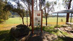
The wayside stop consisting of a shelter, seating and a storyboard was erected to commemorate the 2009 Black Saturday Fires.
The bushfires were the most devastating in Australian history; 173 people tragically lost their lives, 414 were injured, more than a million wild and domesticated animals were lost and 450,000 hectares of land were burned.
In February 2009, the Victorian and Commonwealth Governments jointly established the $10 million Community Recovery Fund to assist in community development and recovery after the Victorian bushfires. Funding of $2.5 million was allocated for memorials and commemorative events and has supported the creation of 59 memorials across 18 councils through extensive consultation with those communities impacted by the fires. The memorials include walls, sculptures, places of reflection, storyboards, lookout towers, roadside stops, shelters, signage, murals, plaques and seating, commemorative gardens and rotundas.
Location
| Address: | Running Creek Road, Kancoona Picnic Area, Kancoona, 3691 |
|---|---|
| State: | VIC |
| Area: | AUS |
| GPS Coordinates: | Lat: -36.5451294 Long: 147.0457881 Note: GPS Coordinates are approximate. |
Details
| Monument Type: | Structure |
|---|---|
| Monument Theme: | Disaster |
| Sub-Theme: | Fire |
| Actual Event Start Date: | 07-February-2009 |
| Actual Event End Date: | 07-February-2009 |
| Link: | http://www.rdv.vic.gov.au |
Dedication
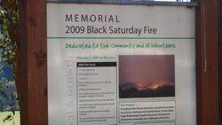
MEMORIAL
2009 Black Saturday Fire
Dedicated to the community and all volunteers
February 7, 2009 on the day...
2009 fire facts
17 houses destroyed
257 properties impacted
2 lives lost
Major infrastructure loss on more than 80 properties
2,000km fencing destroyed
Over 23,000 hectares burnt in the Alpine Shire including 12,680ha of farmland
250+ beef & dairy cattle destroyed or required emergency slaughter
Numerous wildlife required emergency slaughter
This was the first fire to significantly impact on private property in the Alpine Shire
Fire impact
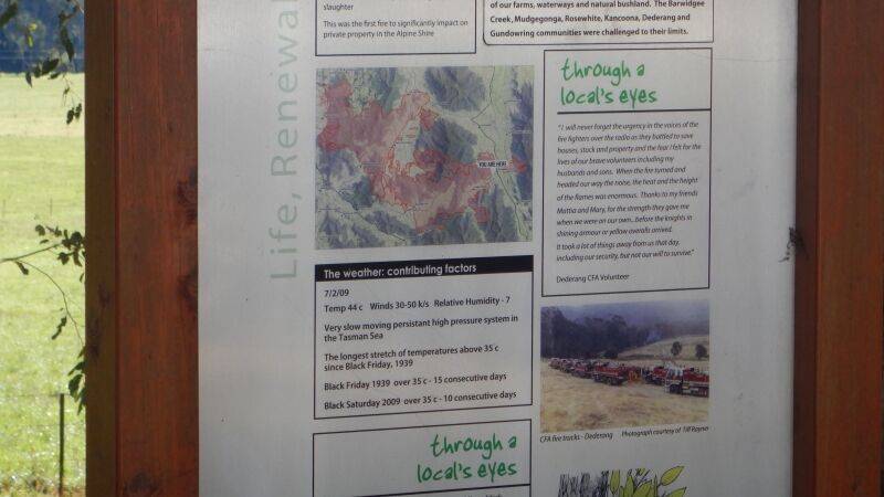
The 2009 bushfires further impacted on the natural ecosystems of our farms, waterways and natural bushland. The Barwidgee Creek, Mudgegonga, Rosewhite, Kancoona, Dederang and Gundowring communities with challenged tot heir limits.
Through a local`s eyes
"I will never forget the urgency in the voices of the fire fighters over the radio as they battled to save houses, stock and property and the fear I felt for the lives of our brave volunteers including my husband and sons. When the fire turned and headed our way the noise, the heat and the height of the flames was enormous. Thanks to my friends Mattia and Marty, for the strength they gave me when we were on our own.. before the knights in shining armour or yellow overalls arrived. It took a lot of things away from us that day, including our security, but not our will to survive.
Dederang CFA volunteer
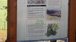
The weather : contributing factors
7 / 2 / 09
Temp 44c Winds 30-50 k/s Relative humidity -7
Very slow moving persistant high pressure system in the Tasman Sea
The longest stretch of temperatures above 35c since Black Friday, 1939
Black Friday 1939 over 35c - 15 consecutive days
Black Saturday 2009 over 35c - 10 consecutive days
Through a local`s eyes
"Maurice said the fire was coming down the middle paddock towards us. Grant took off on his motorbike to bring the cattle back to the house. These cattle had to walk through the fire to get back. By then the fire had roared down to the creek and came up to the eastern side of the house. I saw Grant reversing the tractor over the fire. With the blade down and flames licking the undersize of the tractor, he flattened the fire out with the blade. It came within 10 metres of the house fence."
Mudgegonga resident


