Goyder`s LinePrint Page 
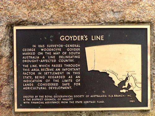
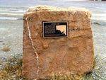
The memorial, erected by the Royal Geographic Society of South Australia in 1983, commemorates Goyder`s Line drawn by Surveyor-General Goyder in 1865 defining the boundary between areas of reasonable and minimal and marginal rainfall.
Goyder`s Line was a line drawn by Surveyor-General Goyder defining the boundary between areas of reasonable and minimal and marginal rainfall. When pastoralists complained during the severe drought of 1863 -1866, Goyder went north to reassess their properties. The first eighteen valuations carried out by Goyder were published in the Adelaide Express in September 1864.
His line of travel, which amounted to nearly 5,000 kilometres on horseback, marked off the line of drought and became known as Goyder`s Line of Rainfall. He drew a line indicating the limit of the rainfall which coincided with the southern boundary of saltbush country. It separated lands suitable for agriculture from those fit for pastoral use only. It also marked areas of reliable and unreliable annual rainfall. Not all agreed with his Line and some even called it Goyder`s line of foolery.
Note: The Royal Geographical Society of South Australia is actively involved in the establishment of monuments and memorials in memory of the explorers and geographers of South Australia.
Location
| Address: | Barrier Highway, Terowie Roadhouse, Terowie, 5421 |
|---|---|
| State: | SA |
| Area: | AUS |
| GPS Coordinates: | Lat: -33.153637 Long: 138.922429 Note: GPS Coordinates are approximate. |
Details
| Monument Type: | Monument |
|---|---|
| Monument Theme: | Disaster |
| Sub-Theme: | Drought |
Dedication
| Approx. Monument Dedication Date: | 1983 |
|---|
GOYDER`S LINE
In 1865 Surveyor-General
George Woodroffe Goyder
Marked On The Map Of South
Australia A 'Line Delineating
Drought-Affected Country`.
The Line, Which Passes Through
This Area, Became An Important
Factor In Settlement In This
State, Being Regarded As An
Indication Of The Limits Of
Lands Considered Safe For
Agricultural Development.
Erected By The Royal Geographical Society Of Australasia (S.A. Branch) Inc.
& The District Council Of Hallett
With Financial Assistance From The State Heritage Fund. 1983


