Home » Themes » Conflict » World War Two
Australia Remembers 1945-1995Print Page 
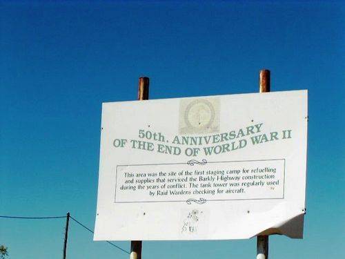
The sign commemorates the 50th anniversary of the end of World War Two. The site was the first staging camp used for refuelling and supplies during the Barkly Highway construction in World War Two.
The road from Mount Isa to Camooweal, known to locals as 'Tojo's Highway', was built during World War Two with American funds and was originally designed as a link between the southern states and the theoretical 'front line' in the Northern Territory.
"Australia Remembers, 1945 - 1995" was a program of activities organised by the Federal Government to commemorate the 50th anniversary of the end of World War Two.
Location
| Address: | Barkly Highway, Camooweal, 4828 |
|---|---|
| State: | QLD |
| Area: | AUS |
| GPS Coordinates: | Lat: -19.921812 Long: 138.12339 Note: GPS Coordinates are approximate. |
Details
| Monument Type: | Sign |
|---|---|
| Monument Theme: | Conflict |
| Sub-Theme: | WW2 |
| Actual Event Start Date: | 15-August-1945 |
| Actual Event End Date: | 15-August-1995 |
Dedication
| Approx. Monument Dedication Date: | 1995 |
|---|
Australia Remembers
1945 - 1995
50th. ANNIVERSARY
OF THE END OF WORLD WAR 11
This area was the site of the first staging camp for refuelling
and supplies that serviced the Barkly Highway construction
during the years of conflict. The tank tower was regularly used
by Raid Wardens checking for aircraft.


