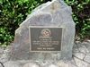
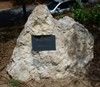
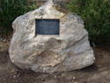
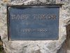
The stones erected by Aborigines commemorate the victims of the Flying Foam Massacres.
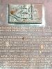
The Flying Foam Massacres were a series of confrontations between settlers and Aboriginal people around Flying Foam Passage on Murujuga (Burrup Peninsula), between February and May 1868. Violence resulted in the deaths of unknown number of Jaburara (or Yaburara, Yapurarra ) people, with estimates ranging between 20 and 150 dead.
The massacres followed the homicides on February 7, on the south west shore of Nickol Bay, of Police Constable William Griffis, an Aboriginal police assistant named Peter and a pearling worker named George Breem, by some Jaburara people as well as the disappearance of a pearling lugger captain, Henry Jermyn.
Pearlers and pastoralists from the surrounding region, with the approval and support of the Government Resident in Roebourne, R. J. Sholl, organised two armed and mounted parties, which travelled overland and by sea respectively to Murujuga, the heartland of the Jaburara. The two parties moved towards each other in a pincer movement.
Because the massacres were the main factor in a sharp decline of the Jaburara population, they are significant and controversial in native title cases for descendants of the Jaburara, as well as cultural heritage issues surrounding the World Monuments-listed Jaburara rock art on Murujuga.
Location
| Address: | Burrup Peninsula, Dampier, 6713 |
|---|
| State: | WA |
|---|
| Area: | AUS |
|---|
| GPS Coordinates: | Lat: -20.530833
Long: 116.819444
Note: GPS Coordinates are approximate. |
|---|
View Google MapDetails
Source: MA