Home » Themes » Technology » Science
Meridian PlaquePrint Page 
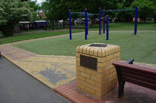
The obelisk was originally erected in 1910 to commemorate the true position of Goulburn which was calculated during the Transit of Venus in 1874. The original plaque was moved in 1997 to allow the construction of a playground and the Meridian Plaque unveiled in 1997 gives the detailed history of the original event.
The fixing of the longitude and the latitude of Goulburn, an historical event, took place with the observation of Venus on December 8, 1874, with the ultimate placing being determined in February, 1875. The true position was determined as a result of the transit observations, Goulburn's position was fixed as latitude 34 degrees 45 minutes 13 seconds south; longitude 9 hours 58 minutes 47.18 seconds east. This was a most significant event in the history of Goulburn and historically very little prominence has been given to it. The minutes of the Municipal Council at a meeting in November, 1874, reveal that the Government astronomer of the day had applied to the council for permission to observe the transit of Venus from Belmore Park. The government had promised to fix and erect an obelisk to mark the direction and location of the town. This was not done until 1910 when Mr Ashley was Mayor.
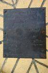
It is most significant to note that the astronomical position reveals that the city is not laid out due north and south but beautifully laid out streets run considerably to the NE and SW. The present plaque in Belmore Park erected by the City Council in 1910 may not be on the identical site where the original observations were made, there is a difference of several minutes and seconds indicated on it. The essential figures on the plaque are as follows: Latitude 34 degrees, 47 minutes, 25.54 seconds south, Longitude 9 hours, 58 minutes, 53.27 seconds east, which can be readily observed are at some variance with the original finding on the 1874 observers.
Location
| Address: | Auburn & Montague Streets, Belmore Park, Sloane Street end, Goulburn , 2580 |
|---|---|
| State: | NSW |
| Area: | AUS |
| GPS Coordinates: | Lat: -34.755299 Long: 149.720583 Note: GPS Coordinates are approximate. |
Details
| Monument Type: | Plaque |
|---|---|
| Monument Theme: | Technology |
| Sub-Theme: | Science |
| Approx. Event Start Date: | 1874 |
| Approx. Event End Date: | 1875 |
Dedication
| Approx. Monument Dedication Date: | 1910 |
|---|
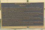
Meridian Plaque
History
The Transit of Venus was recorded in Belmore Park on December 9, 1874 by government astronomers Captain Onslow, Professor Tiveridge and Captain Hixon and photographer Mr Tognaghi. The true position of Goulburn was calculated from the information gained. See original plaque above.
The Transit of Venus occurs when Venus passes between the Earth and the Sun. Transits occur at intervals of 8,122, 8 and 105 years. The next will occur in 2004 and 2012. Captain Cook's party observed the Transit of Venus from Tahiti in 1769.
From an article by S.J.Tazwell, Goulburn Evening Post July 14. 1976.
The original plaque (above) was set in 1910 on an undistinguished concrete block approximately 3.0 metres to the west of its present location. It was moved to allow the construction of the playground in 1997.
Dictionary Definition: Meridian , relating to a moon or sun's position at noon : highest point reached by star etc; period of greatest splendour; imagery circle in sky passing through celestial poles; circle through earth passing through poles.
December 1997.


