Home » Themes » Technology » Industry
Ipswich to Port Cleveland Dray RoutePrint Page 

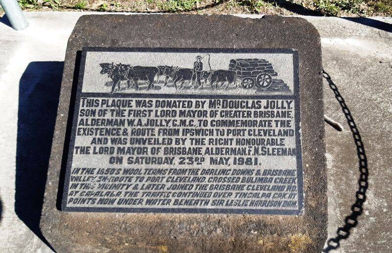
The plaque commemorates the route from Ipswich to Port Cleveland which was used by wool teams in the 1850s.
In the mid to late 1840s, Tom Petrie, the son of Andrew Petrie, the earlier explorer who gave his name to the hill at Belmont and overseer of public works in Brisbane during the penal period, marked a road from Cleveland to Eight Mile Plains crossing Bulimba Creek at Wishart and Upper Mt Gravatt, which extended the dray road passing from "Cowper's Plains" through Ipswich to the Darling Downs, enabling the pastoralists on the Downs to transport their produce to the coast for shipment.
Location
| Address: | Mount Gravatt - Capabala Road , Bulimba Creek Bikeway, Mansfield, 4122 |
|---|---|
| State: | QLD |
| Area: | AUS |
| GPS Coordinates: | Lat: -27.545953 Long: 153.112842 Note: GPS Coordinates are approximate. |
Details
| Monument Type: | Plaque |
|---|---|
| Monument Theme: | Technology |
| Sub-Theme: | Industry |
| Approx. Event Start Date: | |
| Approx. Event End Date: |
Dedication
| Actual Monument Dedication Date: | Saturday 23rd May, 1981 |
|---|---|
| Approx. Monument Dedication Date: |
This plaque was donated by Mr. Douglas Jolly, son of the first Lord Mayor of Greater Brisbane, Alderman W. A. Jolly, C. M.C.,
To commemorate the existence & route from Ipswich to Port Cleveland and was unveiled by the Right Honourable the Lord Mayor of Brisbane, Alderman F. N. Sleeman on Saturday, 23rd May, 1981.
In the 1850`s wool teams from the Darling Downs & Brisbane Valley en route to Port Cleveland, vrossed Bulimba Creek in the vicinity & later joined the Brisbane Cleveland Rd. at Capalaba.
The traffic continued over Tingalpa Crk at points now under water beneath Sir Leslie Harrison Dam.


