Francis MacCabePrint Page 
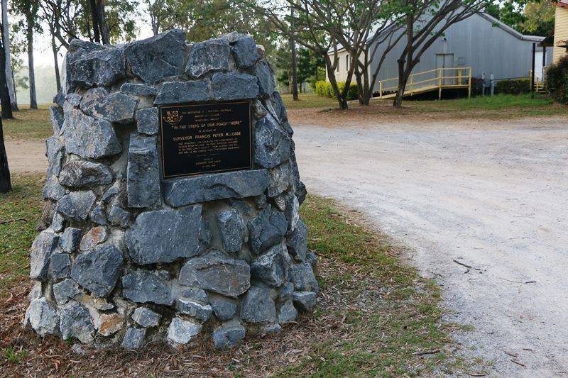
The monument commemorates Francis Peter MacCabe, the first surveyor and explorer of the Port Curtis District.
Francis MacCabe migrated as a free settler in 1841, arriving at a time when opening up the continent through exploration and settlement was a central plank of British Government policy for the Colony of New South Wales. Appointed as a government surveyor, he immediately set to work surveying the more remote areas of New South Wales in Twofold Bay, in the Monaro Plains District and in towns along the Darling River in Western New South Wales. He carried out the first surveys of the Murrumbidgee, Murray and Darling Rivers in Western New South Wales between 1848 and 1852
In 1853, MacCabe was asked by Sir Thomas Mitchell to set up a surveying party to establish a new settlement at Port Curtis (now Gladstone) which at that time was a northerly outpost of New South Wales. By the time MacCabe and his party left Gladstone two years later, they had mapped out a wharf site, established the Town of Gladstone with one hundred and eighty allotments and laid out fifty suburban and fifty four farming allotments.
Location
| Address: | Bruce Highway, Calliope River Historical Village, River Ranch, 4680 |
|---|---|
| State: | QLD |
| Area: | AUS |
| GPS Coordinates: | Lat: -23.959656 Long: 151.151748 Note: GPS Coordinates are approximate. |
Details
| Monument Type: | Monument |
|---|---|
| Monument Theme: | People |
| Sub-Theme: | Government - Colonial |
Dedication
| Actual Monument Dedication Date: | Saturday 23rd April, 1988 |
|---|
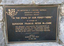
The Institution of Surveyors, Australia
Queensland Division
Bicentennial Project
"In the steps of our forefathers"
In honour of surveyor Francis Peter MacCabe
This monument commemorates the achievements of Francis Peter MacCabe the first surveyor - explorer in the Port Curtis District.
From October 1853 till May 1854 he was camped 1.6km downstream from here.
Erected by Gladstone Town Group
23 April 1988


