Home » Themes » People » Exploration
Matthew FlindersPrint Page 
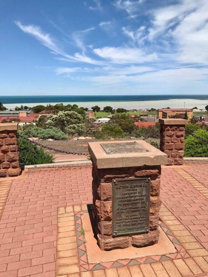
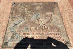
The cairn, with direction finder, commemorates Matthew Flinders. It was erected under the auspices of the Royal Geographical Society of Australasia, South Australia branch, with the generous contribution of Mr Essington Lewis (a famous BHP and Whyalla name.). The lookout where the cairn is located was named Flinders Lookout until 2002 and is now known as the Flinders and Freycinet Lookout.
Captain Matthew Flinders RN (1774 – 1814) was a distinguished English navigator and cartographer, who was the first to circumnavigate Australia and identify it as a continent. In February 1802, Flinders in his ship the Investigator entered Spencer's Gulf, which Flinders named after the second Earl Spencer. Kangaroo Island was discovered; Gulf St Vincent, named after John Jervis, Earl St Vincent was charted and in March Flinders met the French explorer, Nicolas Baudin, at the appropriately named Encounter Bay.
A memorial plaque to the memory of Capt. Matthew Flinders was unveiled on Friday by Sir Herbert Mayo. The memorial, which over looks a wide expanse of Spencer Gulf, is of simple design, comprising an outer semicircular group of bluestone pillars, connected with a heavy chain, with a shorter semi-circular group nearer the roadway. Over 1,000 students from the Whyalla Primary, Whyalla South Primary, Convent School and Technical high school, accompanied by the school bands,marched to the memorial where, after an address by Sir Herbert Mayo and the unveiling of the plaque, the children enacted items depicting events in the life and voyages of Flinders. Frank Nelson, attired as Capt. Flinders and
accompanied by several boys dressed as sailors, read extracts from an early copy of the diary of Flinders, while the chart of Flinders' voyage was exhibited. The chairman of the Whyalla Town Commission (Mr. Charles L. Ryan) introduced Sir Herbert Mayo and the students were granted a half-holiday for the occasion.
Chronicle (Adelaide), 4 May 1950.
Location
| Address: | Farrell & Elliott Streets, Flinders & Freycinet Lookout , Whyalla, 5600 |
|---|---|
| State: | SA |
| Area: | AUS |
| GPS Coordinates: | Lat: -33.037294 Long: 137.579626 Note: GPS Coordinates are approximate. |
Details
| Monument Type: | Monument |
|---|---|
| Monument Theme: | People |
| Sub-Theme: | Exploration |
| Actual Event Start Date: | 09-March-1902 |
| Approx. Event End Date: | 1802 |
Dedication
| Actual Monument Dedication Date: | Friday 28th April, 1950 |
|---|
THIS MEMORIAL
Was Erected Under The Auspices Of The
ROYAL GEOGRAPHICAL SOCIETY
OF AUSTRALASIA, S.A. Branch (Inc)
And With The Generous Contribution Of
ESSINGTON LEWIS Esq., G.H.
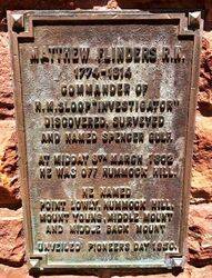
Plaque :
MATTHEW FLINDERS R. N.
1774 - 1814
Commander Of
H. M. Sloop "Investigator"
Discovered, Surveyed
And Named Spencer Gulf.
At Midday 9th March 1802
He Was Off Hummock Hill.
He Named
Point Lowly, Hummock Hill,
Mount Young, Middle Mount
And Middle Back Mount
Unveiled Pioneers Day 1950


