Home » Themes » People » Exploration
Angus McMillan Print Page 
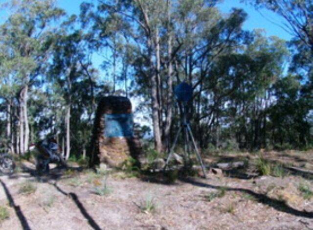
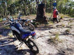
The cairn at the summit of Tom`s Cap indicates that Angus McMillan was first European person see the port he had been seeking from this spot. There is an error in the date inscribed on the monument as it should be 1841 not 1840. A pledge was made at a pilgimage to Tom`s Cap in 1926 that it was to be dedicated to the memory of Angus McMillan.
Public interest in Angus McMillan and Sir Paul Edmund de Strzelecki was initiated in a 1920`s campaign to recognise the European explorers in Victoria, and a chain of commemorative cairns was erected across the region. McMillan’s contribution to the region was also conferred in naming the Federal Electoral Division of McMillan in 1948, which includes original lands of the Gunai Kurnai in west and south Gippsland.
Angus McMillan (14 August 1810 - 18 May 1865), was an explorer and pioneer pastoralist in Gippsland, Victoria, Australia. The Victorian Federal electorate McMillan is named for him. McMillan completed several expeditions, and while he was not necessarily the first to visit many locations, his explorations were the most important in terms of European settlement of Gippsland proper. In 1841, on the final of his early expeditions he located a suitable port for the region, at present day Port Albert.
The view of McMillan as heroic explorer and pioneer was disrupted in the late 1970`s when historian Peter Gardner highlighted the extent of the frontier conflict in Gippsland, naming McMillan as a key figure. The attack on the Brataualung camped at Warrigal Creek following the murder of Ronald Macalister in 1843 was the foremost of several incidents that resulted in the loss of Gunai Kurnai lives. Historian Don Watson named McMillan as the leader of the ‘Highland Brigade’, a group of Gaelic-speaking Scotsmen who conducted reprisals against the Gunai Kurnai. The extent of McMillan’s leadership of these conflicts has been contested although his own accounts indicate that he was involved.
YARRAM, Sunday.— A pilgrimage to Tom's Cap was held today in the stress of heat and bush fires. About 200 attended, representing North and South Gippsland, Mr. R. R. Roberts, president of Yarram Traders' Progress Association, outlined the facts leading to the ceremony, and said the place was brought under notice by Mr. F. A. Devonshire, an old resident, who was too ill to be present. On his motion, seconded by Mr. Walter, M.L.A., and supported by Mr. West, M.L.A., it was decided that Tom's Cap be dedicated to the memory and in the name of the great explorer, Angus McMillan, Cr. Thos. Cullinan, mayor of Sale, moved that those present pledge themselves to assist in further improving the site and the roads leading to Tom's Cap, and in support of a movement to place a memorial to Angus McMillan on the spot. This was seconded by Cr. O'Rourke, president of the Alberton shire, and carried. It was decided that the memorial take the form of a look out.
Age (Melbourne), 16 February 1926.
A party, including Sir James Barrett, the under-secretary for Lands (Mr. H. O. Allan), and members of the Historical Society committee left Melbourne on Friday for Gippsland, where they will accompany the State Governor, who will unveil a series of cairns which have been erected to perpetuate the memory of the explorers Strzelecki and Angus McMillan, and to mark the routes of their chief explorations. The party will unveil several cairns each day, the itinerary to be followed being: Monday.— Omeo, Benambra, Swift's Creek, and Ensay. Tuesday.— Bruthen, Mossiface, Sarsfield, Lucknow, Calulu. Wednesday.— Sale ,Bundalaguah, Stratford, Bushy Park, Heyfield and Rosedale. Thursday.—Tom's Cap, Alberton, and Yarram. Friday.—Traralgon, Koornalla, Mirboo North and Leongatha, Saturday.—Korumburra and Corinella.
Gippsland Times (Vic), 4 April 1927.
Note : As at 21-July-2015, the plaque is no longer attached to the monument.
Location
| Address: | Tom`s Cap Road, Toms`s Cap, Willung South , 3844 |
|---|---|
| State: | VIC |
| Area: | AUS |
| GPS Coordinates: | Lat: -38.322742 Long: 146.796189 Note: GPS Coordinates are approximate. |
Details
| Monument Type: | Monument |
|---|---|
| Monument Theme: | People |
| Sub-Theme: | Exploration |
| Actual Event Start Date: | 19-January-1841 |
| Actual Event End Date: | 19-January-1841 |
| Link: | http://adb.anu.edu.au/ |
Dedication
| Actual Monument Dedication Date: | Thursday 7th April, 1927 |
|---|
From this spot on the 19th January 1840, Angus McMillan sighted the port he had been seeking and the fertile lands of South Gippsland.


