www.monumentaustralia.org.au
Home » Themes » Landscape » Settlement
Highway Highpoint MonumentPrint Page 

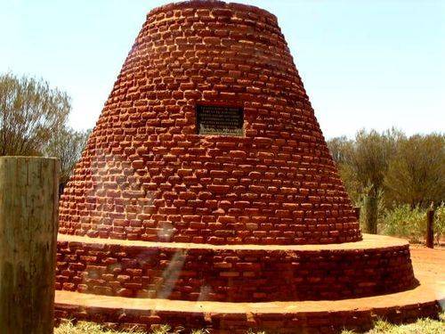
Highway Highpoint
Photographs supplied by Diane Watson
The cairn marks the highest point of the Stuart Highway between Adelaide and Darwin.
The height is 727.2 metres above sea level.
Location
| Address: | Stuart Highway, 20 kilometres North, Alice Springs, 0870 |
|---|---|
| State: | NT |
| Area: | AUS |
| GPS Coordinates: | Lat: -23.524971 Long: 133.860435 Note: GPS Coordinates are approximate. |
Details
| Monument Type: | Monument |
|---|---|
| Monument Theme: | Government |
| Sub-Theme: | State |
| Designer: | Angel Michael Sahariv |
Dedication
| Approx. Monument Dedication Date: | 1962 |
|---|
Front Inscription
Source: MAThis cairn marks the highest point of the main route between Adelaide and Darwin as determined by the Lands and Survey Branch Northern Territory Administration
- Miller Surveyor General N.T.
Erected 1962 by A. M. Sahariv
Monument details supplied by Monument Australia - www.monumentaustralia.org.au


