Home » Themes » Landscape » Settlement
Angus McMillanPrint Page 
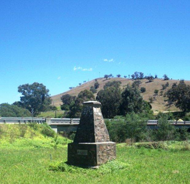
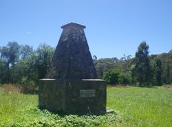
The cairn commemorates Angus McMillan who settled in the area in 1839.
The land around Ensay was originally taken up in 1839 by the explorer of the district Angus McMillan on behalf of his then employer Lachlan Macalister. This was abandoned shortly afterwards in 1841 with the settlement of large areas of land in the more central parts of Gippsland.
At the unveiling of the Bulla memorial for Hume and Hovell, Charles Daley the Secretary of the Victorian Historical Society suggested that the idea be extended to other explorers and a committee was formed to mark out the routes of Charles Sturt, Thomas Mitchell, Angus McMillan, and Count Paul de Strzelecki.
Eighteen cairns or tablets to McMillan were erected at Benambra (to Macfarlane, Pendergast, McKillop) Omeo, Swifts` Creek, Ensay, Bruthen, Mossiface, Sarsfield, Lucknow, Calula (2), Bushy Park, Stratford, Bundalaguah, Sale, Rosedale, Tom`s Gap, Yarram, Port Albert.
A party, including Sir James Barrett, the under-secretary for Lands (Mr. H. O. Allan), and members of the Historical Society committee left Melbourne on Friday for Gippsland, where they will accompany the State Governor, who will unveil a series of cairns which have been erected to perpetuate the memory of the explorers Strzelecki and Angus McMillan, and to mark the routes of their chief explorations. The party will unveil several cairns each day, the itinerary to be followed being: Monday.— Omeo, Benambra, Swift's Creek, and Ensay. Tuesday.— Bruthen, Mossiface, Sarsfield, Lucknow, Calulu. Wednesday.— Sale ,Bundalaguah, Stratford, Bushy Park, Heyfield and Rosedale. Thursday.—Tom's Cap, Alberton, and Yarram. Friday.—Traralgon, Koornalla, Mirboo North and Leongatha, Saturday.—Korumburra and Corinella.
Gippsland Times (Vic), 4 April 1927.
Public interest in Angus McMillan and Sir Paul Edmund de Strzelecki was initiated in a 1920`s campaign to recognise the European explorers in Victoria, and a chain of commemorative cairns was erected across the region. McMillan’s contribution to the region was also conferred in naming the Federal Electoral Division of McMillan in 1948, which includes original lands of the Gunai Kurnai in west and south Gippsland.
The view of McMillan as heroic explorer and pioneer was disrupted in the late 1970`s when historian Peter Gardner highlighted the extent of the frontier conflict in Gippsland, naming McMillan as a key figure. The attack on the Brataualung camped at Warrigal Creek following the murder of Ronald Macalister in 1843 was the foremost of several incidents that resulted in the loss of Gunai Kurnai lives. Historian Don Watson named McMillan as the leader of the ‘Highland Brigade’, a group of Gaelic-speaking Scotsmen who conducted reprisals against the Gunai Kurnai. The extent of McMillan’s leadership of these conflicts has been contested although his own accounts indicate that he was involved.
Location
| Address: | Great Alpine Road, Little River Bridge, Ensay, 3895 |
|---|---|
| State: | VIC |
| Area: | AUS |
| GPS Coordinates: | Lat: -37.380742 Long: 147.830614 Note: GPS Coordinates are approximate. |
Details
| Monument Type: | Monument |
|---|---|
| Monument Theme: | Landscape |
| Sub-Theme: | Settlement |
| Approx. Event Start Date: | 1839 |
| Approx. Event End Date: | 1839 |
| Link: | http://adb.anu.edu.au/ |
Dedication
| Actual Monument Dedication Date: | Monday 4th April, 1927 |
|---|
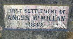
First settlement of Angus McMillan
1839.


