Home » Themes » Landscape » Settlement
Pioneers of Fernvale DistrictPrint Page 
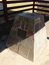
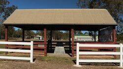
The cairn commemorates the pioneers of the Fernvale District and was unveiled as a Bicentenary Project in 1988.
Fernvale falls within the area formerly occupied by the Indigenous Jagera people. Following the British Government’s establishment of a penal settlement where the city of Brisbane now stands, an embargo was placed on the occupation of land within fifty miles of the ‘closed’ penal establishment. Several officers of the colony made journeys of exploration up the Brisbane River, passing through the area which would become Fernvale. After Alan Cunningham`s discovery in 1828 of Cunninghams Gap a wave of squatters travelled from Sydney via the inland areas of New England and the Darling Downs, bringing sheep to settle on the rich pastures of the Brisbane Valley, taking up runs of tens of thousands of acres.
When the embargo was lifted in 1842, the first Europeans to select land and settle in the Fernvale area were Edmund Blucher Uhr and his brother, whose river frontage run they called Fernie Lawn.This large, unfenced holding which included the area now known as Fernvale was purchased from the Uhr brothers by the North family early in 1843. Wivenhoe, the adjoining station higher up the Brisbane River, was then taken up by Edmund Blucher Uhr and J. S. Ferriter until it too was bought by the North family in 1849. Part of this land was called North’s Pocket, now known as Wivenhoe Pocket
The future township of Fernvale became a known stop for bullock wagons and cattle drovers, who frequently camped by the river overnight before crossing en route to the rapidly growing timber and grazing areas to the north. At the time, Fernvale comprised two separate areas: Harrisborough, named after the Harris Brothers stores, and Stinking Gully named after the watercourse which separated the two areas. Although the town changed its name to Fernvale when the new Telegraph Office opened in 1879, the school retained the old name until 1889, the last establishment in the town to change.
Location
| Address: | Banks Creek Road, Fernvale Showgrounds, Fernvale, 4306 |
|---|---|
| State: | QLD |
| Area: | AUS |
| GPS Coordinates: | Lat: -27.454413 Long: 152.655921 Note: GPS Coordinates are approximate. |
Details
| Monument Type: | Monument |
|---|---|
| Monument Theme: | Landscape |
| Sub-Theme: | Settlement |
| Actual Event Start Date: | 26-January-1788 |
| Actual Event End Date: | 26-January -1988 |
Dedication
| Approx. Monument Dedication Date: | 1988 |
|---|
Australia
1788 - 1988
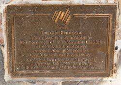
To our pioneers
This plaque is dedicated to the pioneers of the Fernvale District, whose skill and energy were responsible for the development we have today.
An Australian Bicentennial Project, with financial assistance from the Queensland State Government.


