Home » Themes » Landscape » Settlement
Centenary of the Shire of BullooPrint Page 
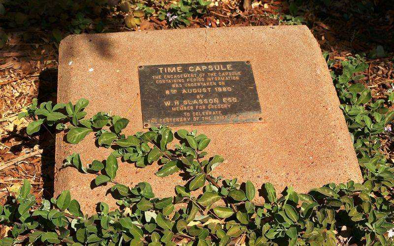
The time capsule commemorates the centenary of the Shire of Bulloo in 1980.
The Shire of Bulloo is a local government area in South West Queensland, Australia. Cameron Corner, the point where New South Wales, Queensland and South Australia meet, is located at the south west corner of the shire. The Bulloo Shire covers an area of 73,807.6 square kilometres (28,497.3 sq mi), and its administrative centre is the town of Thargomindah.
Paroo Division was established on 11 November 1879 as one of the original divisions proclaimed under the Divisional Boards Act 1879. On 3 June 1880, the western part of the Paroo Division was separated to create the Bullo Division. Bulloo Division became the Shire of Bulloo on 31 March 1903. On 17 July 1930 Shire of Bulloo was abolished and absorbed into Shire of Quilpie, but was re-instated on 4 July 1931.
Location
| Address: | Dowling Street, Council Offices, Thargomindah, 4492 |
|---|---|
| State: | QLD |
| Area: | AUS |
| GPS Coordinates: | Lat: -27.996743 Long: 143.822153 Note: GPS Coordinates are approximate. |
Details
| Monument Type: | Time Capsule |
|---|---|
| Monument Theme: | Landscape |
| Sub-Theme: | Settlement |
| Approx. Event Start Date: | 1880 |
| Approx. Event End Date: | 1980 |
Dedication
| Actual Monument Dedication Date: | Friday 8th August, 1980 |
|---|
Time Capsule
The encasement of the capsule containing period information was undertaken on 8th August 1980 by W. H. Glasson Esq. Member for Gregory
To celebrate the Centenary of the Shire of Bulloo


