Home » Themes » Landscape » Settlement
Proclamation of Horseshoe BayPrint Page 

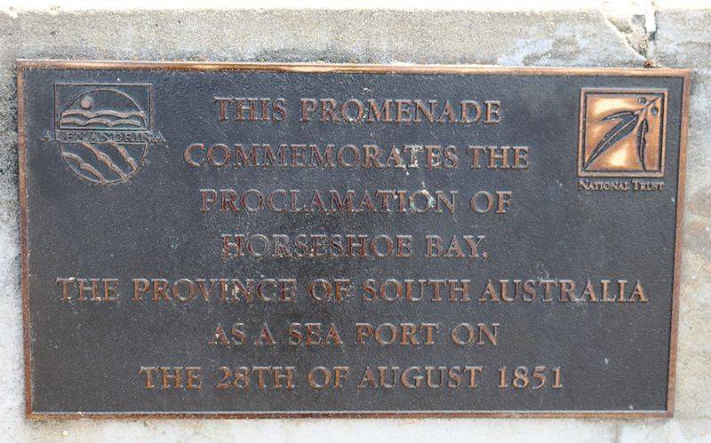
Port Elliot was proclaimed a port 28 August 1851, its boundaries extending from Freeman Nob to Pullen Island (formerly Lipsons Island) and to Frenchmans Rocks and the beach. It extended three nautical miles to seaward. The jetty, under Freeman Nob, was completed in May 1852, and was considered sufficiently well protected from the south-west swell. An obelisk was erected on top of Freeman Nob in early 1852, as a guide for ships; a blue flag was raised on the flagstaff when the channel into the port was considered unsafe. The obelisk was visible for 10 miles out to sea.
The vessels which used it were largely small coasting vessels, though there were a number of ships which loaded directly for overseas ports. However it was the number of wrecks in the bay which spelt its doom. In 1853 the schooner Emu was wrecked with the loss of all lives and in 1856 four vessels were wrecked. From this date the number of ships using Port Elliot declined, and in 1860 another two vessels were wrecked, confirming the general opinion of the bay's unsuitability. Io in 1865 was the last ship to use the port.
The total amount spent on facilities to make a port at Horseshoe Bay had been £30,000. By 1864 Victor Harbor was the port for the River Murray trade - Port Elliot was effectively closed as a port, after a short and disastrous life.
Location
| Address: | The Cutting, Port Elliot, 5212 |
|---|---|
| State: | SA |
| Area: | AUS |
| GPS Coordinates: | Lat: -35.532885 Long: 138.684221 Note: GPS Coordinates are approximate. |
Details
| Monument Type: | Walkway |
|---|---|
| Monument Theme: | Landscape |
| Sub-Theme: | Settlement |
| Actual Event Start Date: | 18-August-1851 |
| Actual Event End Date: | 18-August-1851 |
Dedication
This promenade commemorates the proclamation of Horseshoe Bay, the Province of South Australia as a sea port on the 28th of August 1851.


