Home » Themes » Landscape » Settlement
Pioneers of Port FairyPrint Page 

In the early 19th century whalers and seal hunters used the coast in this region. The bay was named by the crew of the whaler The Fairy in 1828.
John Griffiths established a whaling station in 1835 and a store was opened in 1839. In 1843, James Atkinson, a Sydney solicitor, purchased land in the town by special survey. He drained the swamps, subdivided and leased the land, and built a harbour on the Moyne River. He named the town "Belfast" after his hometown in Ireland. The post office opened on 1 July 1843 (the post office actually opened in 1837 as "Port Fairy" but was renamed "Belfast" on 1 January 1854 before reverting to the original name on 20 July 1887.)
Agriculture developed in the region, and Belfast became an important transport hub. By 1857 the town had a population of 2,190. In the mid-to-late 19th century, Belfast was one of Australia's largest ports, catering to the whaling industry. In 1887 the town was renamed Port Fairy as a result of an Act of Parliament.
Location
| Address: | Regent Street, Port Fairy, 3284 |
|---|---|
| State: | VIC |
| Area: | AUS |
| GPS Coordinates: | Lat: -38.381234 Long: 142.237708 Note: GPS Coordinates are approximate. |
Details
| Monument Type: | Plaque |
|---|---|
| Monument Theme: | Landscape |
| Sub-Theme: | Settlement |
| Approx. Event Start Date: | 1810 |
Dedication
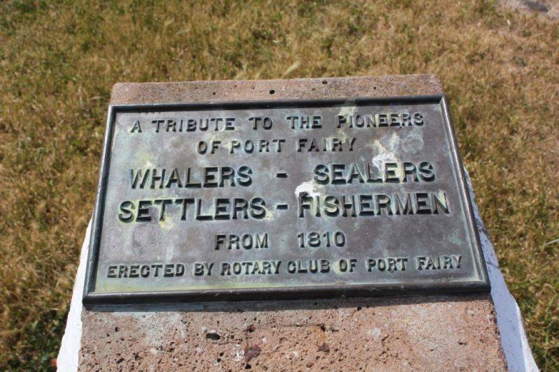
A tribute to the pioneers of Port Fairy
Whalers - Sealers - Settlers - Fishermen
From 1810
Erected by Rotary Club of Port Fairy


