Home » Themes » Landscape » Exploration
Major Thomas Mitchell Print Page 
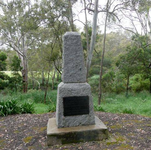
The obelisk commemorates the site of Major Thomas Mitchell's camp in 1836. It was unveiled during the centenary celebrations.
At the unveiling of the Bulla memorial for Hume and Hovell, Charles Daley the Secretary of the Victorian Historical Society suggested that the idea be extended to other explorers and a committee was formed to mark out the routes of Charles Sturt, Thomas Mitchell, Angus McMillan, and Count Paul de Strzelecki.
Thirty-five cairns or tablets to Mitchell were erected at Nyah West, Swan Hill, Cohuna, Mount Pyramid, Fernihurst, Wedderburn, Kanya, Stawell, Mount William, Horsham, Mount Arapiles, Miga Lake, Harrow, Coleraine, Casterton, Dartmoor, Isle of Bags, Portland, Mount Rouse, Mount Napier, Hamilton, Lake Repose, Dunkeld, Middle Creek, Mount Greenock, Mitchellstown, Nagambie, Castlemaine, Expedition Pass, Kyneton, Benalla, Wangaratta, Chiltern, Gooramadda and a public park at Natimuk (Major Mitchell Park, Mount Arapiles, Natimuk).
A largely-attended meeting of Dartmoor residents was held in the local hall, when it was decided to erect a suitable memorial cairn in honor of Major Mitchell, who occupied a camtp on the site of that township on his overland journey to Portland nearly one hundred years ago. Major Mitchell records in his diary that his party camped for several days on a large, clear promontory of land about half a mile from the junction of the Glenelg and Crawford rivers. This headland, which overlooks the township, is known at Dartmoor as "Major Mitchell's Look-out," and it is planned to erect the cairn on the spot. The project has been left in the hands of the Dartmoor Progress Association.
Portland Guardian (Vic.), 2 September 1935.
In order that the Centenary of Dartmoor may be fittingly observed, the residents have arranged appropriate celebrations. An obelisk has been erected near the site of Major Mitchell's camp of August 17th, 1836, and arrangements have been made for Sir James Barrett to perform the unveiling ceremony on December 19th, at 2 p.m.
Portland Guardian (Vic.), 21 September 1936.
Location
| Address: | Gambier Road, Fort O`Hare Campground, Dartmoor, 3304 |
|---|---|
| State: | VIC |
| Area: | AUS |
| GPS Coordinates: | Lat: -37.926319 Long: 141.285214 Note: GPS Coordinates are approximate. |
Details
| Monument Type: | Monument |
|---|---|
| Monument Theme: | People |
| Sub-Theme: | Exploration |
| Actual Event Start Date: | 12-August-1836 |
| Actual Event End Date: | 12-August-1836 |
Dedication
| Actual Monument Dedication Date: | Saturday 19th December, 1936 |
|---|
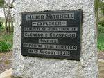
Major Mitchell
- Explorer -
Camped at junction of Glenelg & Crawford Rivers, opposite this obelisk
12th August 1836


