Home » Themes » Landscape » Exploration
Hume & Hovell Print Page 
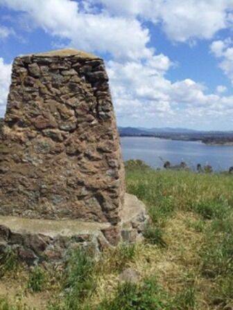
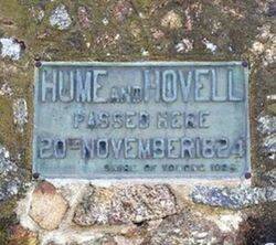
The cairn commemorates the explorers Hume and Hovell who passed through the area in 1824. The cairn was erected on a site which overlooked the junction of the Mitta and the Murray Rivers which was the site of the explorers first camp in Victoria. The cairn was unveiled in 1924, the centenary year of the exploration.
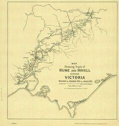
In 1824, Hamilton Hume and William Hovell led an expedition of discovery to find new grazing land for the colony. They and their party trekked south from Appin to Lake George, then on into Victoria, keeping west of the Great Dividing Range and ending up at Corio Bay, on the Victorian coast, where present day Geelong is situated. Hovell mistakenly believed they had arrived at Westernport, and did not realise his mistake until after his return.
At the centenary of Hume and Hovell exploration in 1924 a committee was formed to co-ordinate and organise local celebrations along the route from Albury to Corio Bay. An itinerary was created for the unveiling ceremonies giving the hour and date for each place concerned from 15 to 21 November 1924.
Monuments, cairns or plaques commemorating this expedition were erected at Allan`s Flat, Avenel, Back Creek, Barjarg, Bellbridge, Broadford, Bulla, Deer Park, Ebden, Euroa, Everton, Hansonville, Hume Reservoir, Kilmore, Lara, Lima South, Meadow Creek, Molyullah, Mount Buffalo, Moyhu, Murmungee, Myrtleford, Samaria, Samaria West, Seymour, Staghorn Flat, St Albans, Stanley, Strath Creek, Swanpool, Tatong (Dodd`s Crossing), Violet Town, Warrenbayne West, Werribee, Whorouly, Woodfield Yarck and Yea.
The location of the plaques erected at Lima South is unknown. It is believed that the plaque at Hansonville has come from another location as the date on the plaque does not match the date that the expedition was there.
Please note : This monument is on private property, and you will need the owner's permission to visit the monument.
Location
| Address: | Kurrajong Gap Road, Bethanga, 3691 |
|---|---|
| State: | VIC |
| Area: | AUS |
| GPS Coordinates: | Lat: -36.108352 Long: 147.061314 Note: GPS Coordinates are approximate. |
Details
| Monument Type: | Monument |
|---|---|
| Monument Theme: | People |
| Sub-Theme: | Exploration |
| Actual Event Start Date: | 20-November-1824 |
| Actual Event End Date: | 20-November-1824 |
| Link: | https://www.sl.nsw.gov.au/stories/h… |
Dedication
| Actual Monument Dedication Date: | Tuesday 18th November, 1924 |
|---|
Hume and Hovell passed here
20th November 1824


 Hume and Hovell Centenary
