Home » Themes » Landscape » Exploration
Major Thomas Mitchell ExpeditionPrint Page 
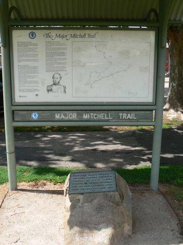
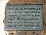
The plaque and Major Mitchell Trail signage commemorates Major Thomas Mitchell's expedition of 1836 who camped near the site.
A memorial drinking fountain to Major Mithell was unveiled in the Botanic Gardens on the 9th November 1930 but this fountain appears to no longer exist.
At the unveiling of the Bulla memorial for Hume and Hovell, Charles Daley the Secretary of the Victorian Historical Society suggested that the idea be extended to other explorers and a committee was formed to mark out the routes of Charles Sturt, Thomas Mitchell, Angus McMillan, and Count Paul de Strzelecki.
Thirty-five cairns or tablets to Mitchell were erected at Nyah West, Swan Hill, Cohuna, Mount Pyramid, Fernihurst, Wedderburn, Kanya, Stawell, Mount William, Horsham, Mount Arapiles, Miga Lake, Harrow, Coleraine, Casterton, Dartmoor, Isle of Bags, Portland, Mount Rouse, Mount Napier, Hamilton, Lake Repose, Dunkeld, Middle Creek, Mount Greenock, Mitchellstown, Nagambie, Castlemaine, Expedition Pass, Kyneton, Benalla, Wangaratta, Chiltern, Gooramadda and a public park at Natimuk (Major Mitchell Park, Mount Arapiles, Natimuk).
Location
| Address: | Mair Street, Benalla, 3672 |
|---|---|
| State: | VIC |
| Area: | AUS |
| GPS Coordinates: | Lat: -36.5519 Long: 145.981733 Note: GPS Coordinates are approximate. |
Details
| Monument Type: | Monument |
|---|---|
| Monument Theme: | Landscape |
| Sub-Theme: | Exploration |
| Actual Event Start Date: | 13-October-1836 |
| Actual Event End Date: | 13-October-1836 |
Dedication
Explorer, Major Thomas L. Mitchell, fourth Surveyor General of N.S.W. (Later Colonel Sir Thomas Mitchell), and his party camped near here on 13 October 1836


 Mitchell Fountain Unveiling 1930
