Home » Themes » Landscape » Exploration
Fort Bourke StockadePrint Page 

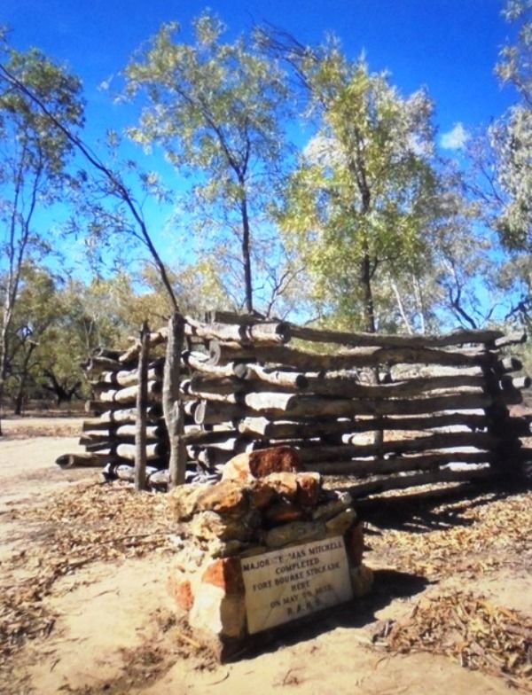
The cairn marks site of the Fort Bourke stockade, built by Major Thomas Mitchell to protect stores depot from attack by aborigines.
In 1835 Mitchell had bad relations with the local Aborigines and he felt a fort was suitable protection against their attacks. It was named Fort Bourke after the governor of New South Wales, Sir Richard Bourke (1777-1855). Eventually the district and later the town came to be known by this name.
TABLET FOR BOURKE
Commemoration Of Mitchell.
The Royal Australian Historical Society will this week send to Bourke a marble tablet to be affixed to a cairn of stones built by Bourke district residents on the site of Major (afterwards Sir Thomas) Mitchell's stockade near Bourke. Mitchell camped on the site of the cairn and named it Fort Bourke Stockade during his exploration journey of 1835. The stockade was built on the west bank of the Darling River, and was intended to protect Mitchell and his party from hostile aborigines.
The tablet is the outcome of a visit by the honorary secretary of the Historical Society, Mr. E. C. Rowland, to the Commonwealth Jubilee celebrations at Bourke last year. Local residents visited the site of the stockade, those attending being asked to provide an "entrance fee" of one stone each with which to build the cairn. The tablet bears the inscription: "Major Thomas Mitchell Completed Fort Bourke Stockade on May 29, 1835. R.A.H.S."
The Sydney Morning Herald (NSW), 10 November 1952.
Location
| Address: | Louth Road, Approximately 4 kilometres off the road on dirt track, Bourke, 2840 |
|---|---|
| State: | NSW |
| Area: | AUS |
| GPS Coordinates: | Lat: -30.129715 Long: 145.833901 Note: GPS Coordinates are approximate. |
Details
| Monument Type: | Monument |
|---|---|
| Monument Theme: | Landscape |
| Sub-Theme: | Exploration |
| Approx. Event Start Date: | 1835 |
| Actual Event End Date: | 29-May-1835 |
Dedication
Major Thomas Mitchell
Completed
Fort Bourke Stockade
Here On May 29, 1835.
R.A.H.S


