Home » Themes » Landscape » Exploration
The Simpson Desert Expedition 1939Print Page 
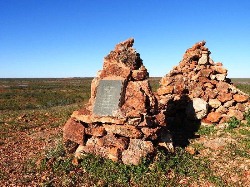
The cairn commemorates the 1939 Simpson Desert Expedition led by Cecil T. Madigan in 1939. The Simpson is a sand-ridge desert extending approximately 322 kilometres west to east, the ridges running parallel from north to south at approximately half a kilometre intervals, some reaching as high as 30 metres.
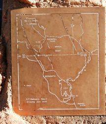
Madigan planned a ground crossing in the winter of 1939. A party of nine, including a biologist, a botanist, a photographer and a radio operator, with nineteen camels, made the exhausting crossing from Andado station in the Northern Territory to Birdsville in twenty-five days. It verified Madigan`s previous conclusions that the area was a wasteland.
This last classic Australian exploration adventure pioneered the use of mobile radio communication; national broadcasts were made through the Australian Broadcasting Commission from desert camps. The scientific results were published and also a popular account, "Crossing the Dead Heart" (Melbourne, 1946).
Location
| Address: | Poodnitera Hill, Hale, 0852 |
|---|---|
| State: | NT |
| Area: | AUS |
| GPS Coordinates: | Lat: -24.57501 Long: 135.723611 Note: GPS Coordinates are approximate. |
Details
| Monument Type: | Monument |
|---|---|
| Monument Theme: | Landscape |
| Sub-Theme: | Exploration |
| Actual Event Start Date: | 05-June-1939 |
| Actual Event End Date: | 07-June-1939 |
| Link: | http://adbonline.anu.edu.au/adbonli… |
Dedication
| Approx. Monument Dedication Date: | May-1962 |
|---|
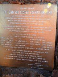
On June 5th 1939
THE SIMPSON DESERT EXPEDITION 1939
Led By Cecil T. Madigan M.A., D.Sc., B.E., F.G.S
Erected This Cairn On This Hill Near The Junction Of The Hale And The Todd And Recorded The Names Of Members Of The Party On A Note Left In A Tobacco Tin.
The Expedition Successfully Crossed The Simpson Desert By Camel From This Point To Birdsville Via The Hay River And The Mulligan. The Party Arrived In Birdsville On July 6th 1939
Members Of The Party Were : -
Cecil T. Madigan. Geologist. University of Adelaide
Robert L. Crocker Botanist. Albert Hubbard Cook.
Harold O Fletcher Palaeontologist. Jack Beejah Camel Driver. Robert Sampson Wireless Operator. Noorie Moosha Camel Driver. David Marshall Photographer. Andy Black Tracker.
Lali. Aboriginal Guide, Provided By Bob McDill Of Andada Station.
In 1916 T. E. Dale Surveyor General Of South Australia Also
Passed This Point On A Traverse From
Charlotte Waters To The MacDonnell Ranges.
This Later Cairn Was Erected by R. C. & G. A. F. Sprigg And D. Von Sanden of Adelaide And Leo. J. Corbett Of Alice Springs
May 1962
Geosurveys of Australia Ltd
And Beach Petroleum N. L.
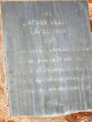
THE
SIMPSON DESERT
EXPEDITION
1939
Dr C. T. Madigan With 8 Men And 17 Camels
Left This Point On 7th June 1939
And Arrived At Birdsville 29 Days Later
Erected By The Royal Geographical Society
Of Australasia South Australian Branch
1962


