Home » Themes » Government » State
Completion of the Clarrie Hall DamPrint Page 
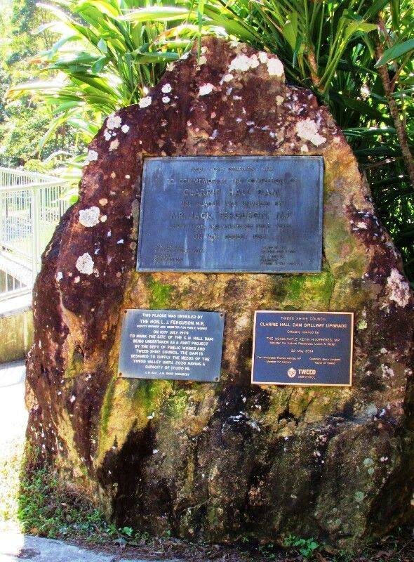
The plaque commemorates the completion of the Clarrie Hall Dam in August 1983.
Clarrie Hall Dam is a minor ungated concrete faced rockfill embankment dam with an uncontrolled concrete-lined shute spillway across the Doon Doon Creek, located upstream of the small town of Uki, in the Northern Rivers region of New South Wales, Australia.
Clarrie Hall dam construction commenced in 1979 and it was opened in 1983 with the unique distinction of being full after heavy rainfall prior to the opening ceremony. The primary function of the dam is to provide storage of water for Tweed Shire's drinking water supply, by releasing water downstream into Doon Doon Creek when levels of freshwater in the Tweed River fall below 95%, which occurs mostly in winter and spring. Otherwise the natural flows of the Tweed River provide 80% of the water needs of the Shire.
Location
| Address: | Clarrie Hall Dam Road, Clarrie Hall Dam, Uki, 2484 |
|---|---|
| State: | NSW |
| Area: | AUS |
| GPS Coordinates: | Lat: -28.437908 Long: 153.306101 Note: GPS Coordinates are approximate. |
Details
| Monument Type: | Plaque |
|---|---|
| Monument Theme: | Government |
| Sub-Theme: | State |
| Actual Event Start Date: | |
| Actual Event End Date: |
Dedication
| Actual Monument Dedication Date: | Friday 12th August, 1983 |
|---|
Public Works Department, N. S. W.
To commemorate the completion of "Clarrie Hall" Dam
This plaque was unveiled by Mr. Jack Ferguson, M. P. Deputy Premier and Minister for Public Works on 12th August 1983.
W. K. Pilz, O. B. E. Director of Public Works
R. J. Eagle Chief Engineer
J. C. Boyd, M.P. Member for Byron
Cr. Y. Rowse President Tweed Shire Council


