Home » Themes » Government » State
Ord River Catchment Regeneration Project Print Page 

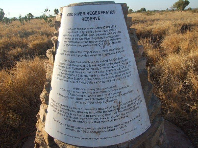
The cairn commemorates some 80 staff of the Department of Agriculture WA (now DAFWA) who, between 1960 and 1998, worked on the Ord River Catchment Regeneration Project. The cone shaped cairn was built out of local limestone flagstones. Construction of the cairn was approved and partly funded by DAFWA and the Department of Parks and Wildlife.
It is located on the Duncan Road near where the five houses and workshops of the project’s headquarters stood from 1962 until being completely demolished in 1998.
The project, the largest in Australia’s rangelands, aimed to revegetate bare, severely degraded and eroded parts of the Ord River catchment in order to minimise siltation of Lake Argyle, which provides water to the Kununurra irrigation area. Decades of excessive uncontrolled grazing by cattle between the late 1880s and 1950s were responsible for the degradation.
The project area, which is now called the Ord River Regeneration Reserve, is managed by the Department of Parks and Wildlife.
It initially covered about 10 000 square kilmetres of the total area of the catchment of Lake Argyle of 46 000 square kilometres. It extended about 215 kilometres from north to south and included parts of Mistake Creek Station in the north, all of Ord River and Turner stations and parts of Flora Valley and other stations in the south.
Location
| Address: | Duncan Road, near Ord River Station, Ord River, 6770 |
|---|---|
| State: | WA |
| Area: | AUS |
| GPS Coordinates: | Lat: -17.366122 Long: 128.952543 Note: GPS Coordinates are approximate. |
Details
| Monument Type: | Monument |
|---|---|
| Monument Theme: | Government |
| Sub-Theme: | State |
Dedication
| Approx. Monument Dedication Date: | July -2013 |
|---|
Ord River Regeneration Reserve
This cairn commemorates some 80 staff of the Department of Agriculture (now Department of Agriculture and Food WA) who, between 1960 and 1998, worked on the Ord River Regeneration Project and were responsible for the and stabilisation of severely eroded parts of the Ord River catchment.
The purpose of this Project was to minimise siltation of Lake Argyle which provides water for irrigation at Kununurra.
The Project area which is now called the Ord River Regeneration Reserve and is managed by the Department of Environment and Conservation initially covered about 10, 000 sq.km of the total area of the catchment of Lake Argyle of 46,000 sq.km. It is extended about 215km north to south and included parts of Mistake Creek Station in the north, all of Ord River and Turner Stations and parts of Flora Valley and other stations in the south.
Work over many years entailed
- Fencing the country into a large number of paddocks
- Removing all cattle and feral donkeys
- Reseeding with Buffel and Birdwood grass and Kapok bush using contour strip cultivation
This country became a barren, severely degraded and eroded landscape due to the decades of uncontrolled grazing by cattle between the late 1800s and 1950. The Project was highly successful at reversing much of the damage and couple with continuing natural regeneration, has produced the dense grassy savannah woodlands that you see here today.
The Project's headquarters which stood just west of this point were erected in 1962 and demolished in 1998.
Erected in July 2013 by Thomas Gee and Alan Payne with funding assistance from DAFWA and DEC


