www.monumentaustralia.org.au
Home » Themes » Government » Local
Shire of Marong Centenary Print Page 

01-December-2014
Photographs supplied by Sandra Brown
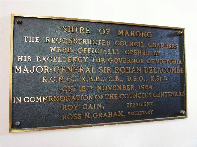
The official opening plaque of the reconstructed council chambers commemorates the council`s centenary in 1964.
Marong was first incorporated as a road district on 27 August 1861, and became a shire on 23 December 1864. On 1 October 1915, the Borough of Raywood, which was gazetted on 17 January 1865 on 23.31 square kilometres (9.00 sq mi) of land 28 kilometres (17 mi) north of Bendigo was united with Marong. On 1 October 1990, the Shire of Marong became a Rural City, under the Local Government Act 1989.
View Google Map
Marong was first incorporated as a road district on 27 August 1861, and became a shire on 23 December 1864. On 1 October 1915, the Borough of Raywood, which was gazetted on 17 January 1865 on 23.31 square kilometres (9.00 sq mi) of land 28 kilometres (17 mi) north of Bendigo was united with Marong. On 1 October 1990, the Shire of Marong became a Rural City, under the Local Government Act 1989.
Location
| Address: | Calder Highway, Marong Shire Hall, Marong, 3515 |
|---|---|
| State: | VIC |
| Area: | AUS |
| GPS Coordinates: | Lat: -36.735953 Long: 144.133546 Note: GPS Coordinates are approximate. |
Details
| Monument Type: | Plaque |
|---|---|
| Monument Theme: | Government |
| Sub-Theme: | Local |
| Approx. Event Start Date: | 1864 |
| Approx. Event End Date: | 1964 |
Dedication
| Actual Monument Dedication Date: | Thursday 12th November, 1964 |
|---|
Front Inscription
SHIRE OF MARONG
THE RECONSTRUCTED COUNCIL CHAMBERS
WERE OFFICIALLY OPENED BY
HIS EXCELLENCY THE GOVERNOR OF VICTORIA
MAJOR-GENERAL SIR ROHAN DELACOMBE
K.C.M.G., K.B.E., C.B., D.S.O., K. St.J.
ON 12th NOVEMBER, 1964
IN COMMEMORATION OF THE COUNCIL`S CENTENARY
ROY CAIN, President
ROSS M. GRAHAM, Secretary
Source: MASHIRE OF MARONG
THE RECONSTRUCTED COUNCIL CHAMBERS
WERE OFFICIALLY OPENED BY
HIS EXCELLENCY THE GOVERNOR OF VICTORIA
MAJOR-GENERAL SIR ROHAN DELACOMBE
K.C.M.G., K.B.E., C.B., D.S.O., K. St.J.
ON 12th NOVEMBER, 1964
IN COMMEMORATION OF THE COUNCIL`S CENTENARY
ROY CAIN, President
ROSS M. GRAHAM, Secretary
Monument details supplied by Monument Australia - www.monumentaustralia.org.au


