Home » Themes » Government » Local
Centenary of Shire of WarracknabealPrint Page 

The Shire of Warracknabeal was a local government area about 200 kilometres (124 mi) west-northwest of Bendigo and 60 kilometres (37 mi) north of Horsham in western Victoria, Australia. The shire covered an area of 1,839 square kilometres (710.0 sq mi), and existed from 1891 until 1995.
Location
| Address: | 39 Scott Street ( Cnr Phillips Street), Warracknabeal Town Hall, Warracknabeal, 3393 |
|---|---|
| State: | VIC |
| Area: | AUS |
| GPS Coordinates: | Lat: -36.24854 Long: 142.395161 Note: GPS Coordinates are approximate. |
Details
| Monument Type: | Plaque |
|---|---|
| Monument Theme: | Government |
| Sub-Theme: | Local |
| Approx. Event Start Date: | 1891 |
| Approx. Event End Date: | 1991 |
Dedication
| Actual Monument Dedication Date: | Wednesday 30th January, 1991 |
|---|
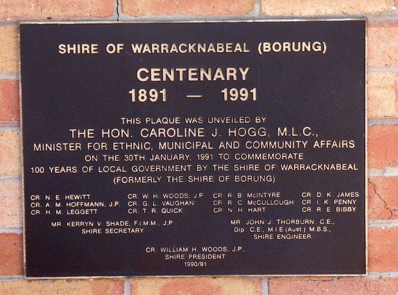
Shire of Warracknabeal (Borung)
CENTENARY
1891 - 1991
This Plaque Was Unveiled By
The Hon. Caroline J. Hogg, M.L.C.,
Minister For Ethnic, Municipal And Community Affairs
On The 30th January, 1991 To Commemorate
100 Years Of Local Government By The Shire Of Warracknabeal
(Formerly The Shire Of Borung)
Cr. N. E. Hewitt Cr. W. H. Woods, J.P. Cr. R. B. McIntyre Cr. D. K. James Cr. A. M. Hoffman, J. P. Cr. G. L. Vaughan Cr. R. C. McCullough Cr. I. K. Penny Cr. H. M. Leggett Cr. T . R. Quick Cr. N. H. Hart Cr. R. E. Bibby
Mr. Kerryn V. Shade, F.I.M.M., J.P. Shire Secretary
Mr. John Thorburn, C.E., Dip. C.E., M.I.E. (aust.) M.B.S., Shire Engineer
Cr. William H. Woods, J.P., Shire President 1990 / 91


