Home » Themes » Government » Local
Proclamation of the Shire of Mansfield 2002Print Page 
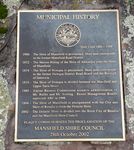
A plaque commemorates the proclamation of the Shire of Mansfield in 2002.
The Shire of Mansfield was a local government area about 185 kilometres (115 mi) northeast of Mebourne, the state capital of Victoria, Australia. The shire covered an area of 3,919.10 square kilometres (1,513.2 sq mi), and existed from 1865 until 1994. Mansfield became a shire on the 31 December 1866. On 18 November 1994, the Shire was abolished, and merged with the City and Shire of Benalla and the Warrenbayne district of Shire of Violet Town into the Shire of Delatite. In 2002 the Delatite Shire was abolished, and a new Shire of Mansfield was created with largely the same territory.
Location
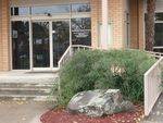
| Address: | Highett Street, Mansfield Shire Council, Mansfield, 3722 |
|---|---|
| State: | VIC |
| Area: | AUS |
| GPS Coordinates: | Lat: -37.053447 Long: 146.0873 Note: GPS Coordinates are approximate. |
Details
| Monument Type: | Plaque |
|---|---|
| Monument Theme: | Government |
| Sub-Theme: | Local |
Dedication
| Actual Monument Dedication Date: | Monday 28th October, 2002 |
|---|
MUNICIPAL HISTORY
Shire Crest 1886-1994
1866 - The Shire of Mansfield is proclaimed. Shire area corresponds ti the former Mansfield Road District.
1872 - The Merton Riding of the Shire of Alexandra joins the Shire of Mansfield.
1874 - The Shire of Howqua is proclaimed. Shire area corresponds to the former Howqua District Road Board and the Borough of Jamieson.
1919 - The Shire of Howqua is divided between Mansfield and Upper Yarra Shires.
1985 - Alpine Resorts Commission assumes administration of Mt. Buller and Mt. Stirling. Resort Management Boards supercede ARC in 1998.
1994 - The Shire of Mansfield is amalgamated with the City and Shire of Benalla to form the Delatite Shire.
2002 - The Delatite Shire is divided into the Rural City of Benalla and the Mansfield Shire Council.
Plaque Commemorates The Proclamation Of The
MANSFIELD SHIRE COUNCIL
28th October 2002


