Home » Themes » Government » Colonial
First Mainland Survey by Colonel William LightPrint Page 
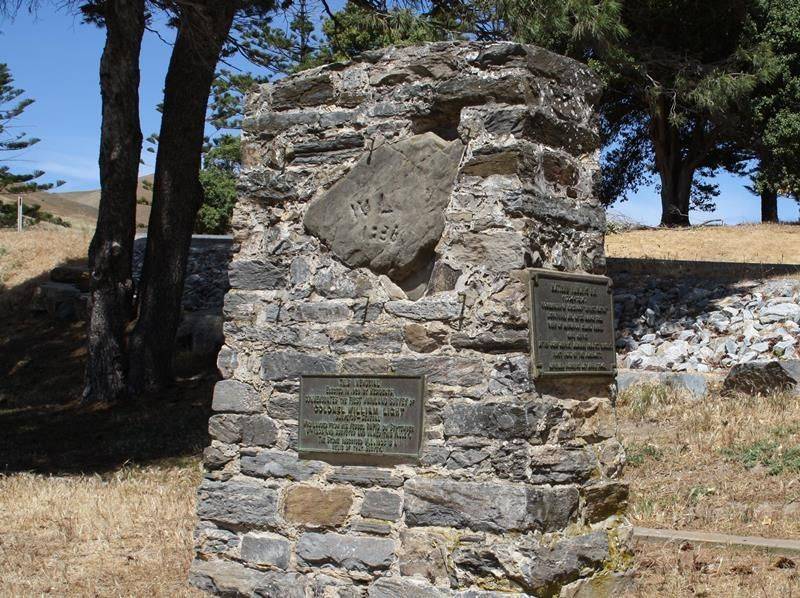
The cairn commemorates the first mainland survey undertaken by Colonel William Light in September 1836.
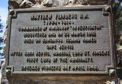
In 1948 a plaque was added to the cairn to commemorate Matthew Flinders naming of Cape Jervis on the 23rd March 1802.
A picnic was held at the Rapid Bay Beach on Saturday afternoon, when there were about 600 people present. After lunch Mr. G. Roper requested the Surveyor-General (Mr T. E. Day) to unveil the cairn, a replica of the stone inscribed by Colonel Light in 1836 (the original of which is in the Adelaide Museum), which had been erected on the spot. Mr. Day outlined the finding of the stone and stated that the stone which was to be unveiled that afternoon was to commemorate the work of Colonel Light for the district and the State.
It was 92 years ago that day that Colonel Light was appointed the first Surveyor-General of South Australia. He dealt with the landing at Antechamber Bay, the exploration of the Gulf of St. Vincent, and the landing at Rapid Bay. The original stone was meant to mark the spot where he first landed, and was found by Mr. H. Hamlyn in 1921. Mr. Hamlyn, who was present at the gathering, told the story of the finding of the stone, and a picture of the brig Rapid, anchored in Rapid Bay, was presented to Mr. Roper.
The Advertiser (Adelaide), 6 February 1928.
Location
| Address: | 2 Park Street, Second Valley Caravan Park, Second Valley, 5204 |
|---|---|
| State: | SA |
| Area: | AUUS |
| GPS Coordinates: | Lat: -35.573695 Long: 138.218676 Note: GPS Coordinates are approximate. |
Details
| Monument Type: | Monument |
|---|---|
| Monument Theme: | Landscape |
| Sub-Theme: | Settlement |
| Actual Event Start Date: | 08-September-1836 |
Dedication
| Actual Monument Dedication Date: | Monday 6th February, 1928 |
|---|
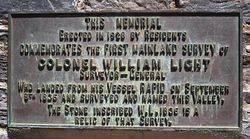
This memorial erected in 1928 by residents commemorates the first mainland survey of Colonel William Light Surveyor-General who landed from his vessel Rapid on September 8th 1836 and surveyed and named this valley.
The stone inscribed W. L. 1836 is a relic of that survey.
Matthew Flinders R. N.
( 1774 - 1814 )
Commander of H.M. Sloop "Investigator" discovered and on 23 March 1802 when on Kangaroo Island named Cape Jervis after John Jervis, Admiral Lord St. Vincent, First Lord of the Admirality.
Unveiled Pioneers Day April 1948.


