Home » Themes » Disaster » Land Transport
40th Anniversary of the Tasman Bridge DisasterPrint Page 
The Tasman Bridge was open to traffic in August 1964. It was a four-lane, high level concrete bridge constructed with a central navigation span for shipping. Prior to 1964, a floating bridge spanned the Derwent.
On Sunday, 5 January 1975 at 9.27 p.m. the bulk carrier Lake Illawarra collided with the Tasman Bridge. Two piers collapsed along with 127 metres of bridge decking. Four cars ran over the gap into the Derwent River, five occupants died while several others managed to escape from two vehicles which teetered on the edge of the gap. Seven crewmen from the Lake Illawarra also lost their lives. The impact of the bridge collapse was quickly felt as Hobart was suddenly cut in two. Eastern shore residents were severely compromised, transport facilities were tested and to compound the issue further, most hospitals, schools, businesses and government offices were located on the western shore.
To mark the 40th Anniversary of the collapse of the Tasman Bridge, in which 12 people tragically lost their lives, a minute’s silence was held at 9.27pm today to mark the exact moment 40 years ago when the MV Lake Illawarra collided with the bridge.
Coinciding with the silence, the Tasman Bridge lights were dimmed.
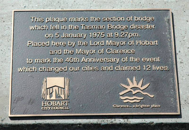
A plaque was unveiled by the Lord Mayor of Hobart, Alderman Sue Hickey and Mayor of Clarence, Alderman Doug Chipman on the rebuilt span of the bridge to commemorate the tragedy, with Tasmanian Minister for Infrastructure Rene Hidding also in attendance.
Lord Mayor Sue Hickey said after some 40 years, it was appropriate not only to remember the Tasman Bridge disaster itself, but also to highlight the impacts the loss of the bridge had on life in greater Hobart, particularly those in the City of Clarence.
Tasmanian Times.com, 5 January 2015.
Location
| Address: | Tasman Highway, Tasman Bridge, Southern side footpath at the position of collapsed span, Montagu Bay, 7018 |
|---|---|
| State: | TAS |
| Area: | AUS |
| GPS Coordinates: | Lat: -42.864592 Long: 147.347601 Note: GPS Coordinates are approximate. |
Details
| Monument Type: | Plaque |
|---|---|
| Monument Theme: | Disaster |
| Sub-Theme: | Land Transport |
| Actual Event Start Date: | 05-January-1975 |
| Actual Event End Date: | 05-January-2015 |
Dedication
| Actual Monument Dedication Date: | Monday 5th January, 2015 |
|---|
This plaque marks the section of bridge
which fell in the Tasman Bridge disaster
on 5 January 1975 at 9.27pm.
Placed here by the Lord Mayor of Hobart
and the Mayor of Clarence
to mark the 40th anniversary of the event
which changed our cities and claimed 12 lives.


