1956 Flood MonumentPrint Page 
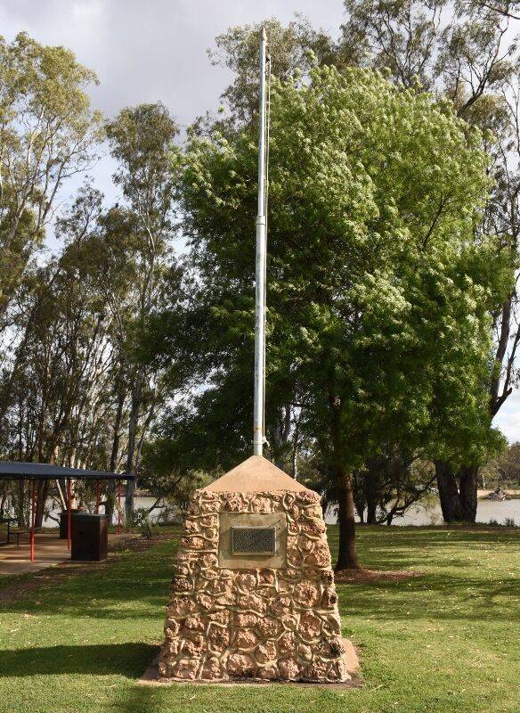
The cairn commemorates those who saved the Curlwaa Irrigation Area from inundation by the floods of 1956.
The 1956 Murray River floods were the worst in recorded history of the Murray River, Australia. The floods devastated many towns across Victoria, New South Wales and South Australia.
Location
| Address: | Silver City Highway, O`Donnell Park, Curlwaa, 2648 |
|---|---|
| State: | NSW |
| Area: | AUS |
| GPS Coordinates: | Lat: -34.111112 Long: 141.986155 Note: GPS Coordinates are approximate. |
Details
| Monument Type: | Monument |
|---|---|
| Monument Theme: | Disaster |
| Sub-Theme: | Flood |
| Approx. Event Start Date: | July-1956 |
| Approx. Event End Date: | August-1956 |
Dedication
| Approx. Monument Dedication Date: | 1959 |
|---|
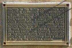
Erected by the Water Conservation and Irrigation Commission
To commemorate the epic struggle of local residents, volunteers from surrounding Districts, detachments from the Armed Forces and Police Department, supported by Ladies Organizations, against the waters of the record flood of July and August 1956.
By their efforts the Curlwaa Irrigation Area was saved from complete inundation by the flood water which reached and
held for six consecutive days a height of 30` on the Curlwaa Gauge.


