Bushfire MemorialPrint Page 
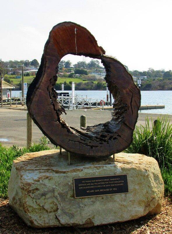
The monument thanks defence forces, emergency services and volunteers for their dedication during the 2019 / 2020 bushfires.
On 30 December 2019 , a state-wide total fire ban was declared as multiple new fires started from dry lightning in the Grampians, Hume and Gippsland regions. Three fires in East Gippsland with a combined area of more than 130,000 ha remained active; some fires burned with sufficient intensity to create pyrocumulonimbus clouds that generated local thunder and lightning. The road network was significantly impacted by these fires and access was cut to a number of communities, sometimes for several days. A Forest Fire Management Victoria (FFMV) contractor died in a vehicle rollover.
Early in the morning on New Year’s Eve, the Banana Track fire reached the coastal town of Mallacoota in the state’s far east. Several thousand people were isolated in the town and more than 60 homes were destroyed. Escape routes were cut off and an estimated 4,000 people gathered on the town’s foreshore, protected by the local Country Fire Authority (CFA) brigade, three CFA strike teams, FFMV firefighters and VIC Police personnel.
On 1 January 2020 there were unconfirmed reports of property and infrastructure losses in several communities, including Mallacoota, Genoa, Reedy Flat, Buchan, Bruthen, Sarsfield, and Gelantipy. The Princes Highway east of Bairnsdale was closed in several places, isolating many communities.
On the evening of 2 January with an estimated 50 fires still burning in the state, the VIC Premier declared a state of disaster for the shires of East Gippsland, Mansfield, Wangaratta Rural, Wellington, Towong and Alpine, and the alpine resorts of Mount Buller, Mount Hotham, Falls Creek and Mount Stirling. People were again warned to leave high risk areas ahead of predicted worsening conditions.
On 3 January, fourteen emergency warnings were issued in fire-affected areas and nearly 2,000 people were evacuated from Mallacoota by air and sea, part of the largest-ever maritime evacuation of Australian citizens following a natural disaster. Evacuations were carried out by the Australian Defence Force (ADF) supported by international defence partners and other agencies. Forty-one firefighters from the United States arrived to support firefighting operations, and a FFMV firefighter died in a two-vehicle collision.
Location
| Address: | Buckland Drive & Allan Drive, Foreshore Area opposite Visitor Information Shed, Mallacoota, 3892 |
|---|---|
| State: | VIC |
| Area: | AUS |
| GPS Coordinates: | Lat: -37.554751 Long: 149.756922 Note: GPS Coordinates are approximate. |
Details
| Monument Type: | Monument |
|---|---|
| Monument Theme: | Disaster |
| Sub-Theme: | Fire |
Dedication
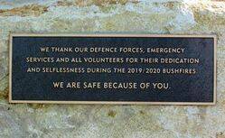
We thank our Defence Forces, Emergency Services and all volunteers for their dedication and selflessness during the 2019 / 2020 bushfires
We are safe because of you


