Moombooldool District Football, Cricket & Tennis PlayersPrint Page 
Location
| Address: | Burley Griffin Way, Moombooldool, 2665 |
|---|---|
| State: | NSW |
| Area: | AUS |
| GPS Coordinates: | Lat: -34.301758 Long: 146.674586 Note: GPS Coordinates are approximate. |
Details
| Monument Type: | Plaque |
|---|---|
| Monument Theme: | Culture |
| Sub-Theme: | Sport |
Dedication
| Actual Monument Dedication Date: | Saturday 6th April, 2013 |
|---|
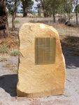
This Plaque recognises the Football, Cricket and Tennis Players of the Moombooldool District.
The Moombooldool Australian Rules Football Club was formed in 1912.
The first game was on the recreation ground was played in 1915. Prior to this matches were played between teams made up of Farmers, Farm Workers and Station hands from the immediate area on a ground which was situated near Moombooldool-Willows road north of the Mumbledool East homestead.
Premierships were won in 1919, 1924, 1927, 1939, 1940, 1946, 1948, 1949 and 1950. the club disbanded at the end of 1951 and combined with Kamarah Club in 1955. This club disbanded in 1970.
The Moombooldool Cricket Club was formed around 1915. Prior to this matches were played across the Mirrool Creek from Rose Bank homestead. The known Premiership years are 1958/ 59 and 1960/61. The club was disbanded in 1970.
The Moombooldool Tennis Club was formed around 1915. Prior to this, the sport was played on courts situated to the east of the village. Use of the courts ceased in the late 1940s.
The plaque also recognises and commemorates those who came before us and acknowledges the endurance and hardship encountered by them in the development of this area.
The Village of Moombooldool
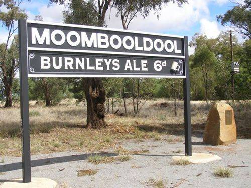
The village of Erin came into being with the arrival of the railway in 1908. Erin was renamed Moombooldool in 1912. Through its existence the village has boasted a Railway Station with a Station Masters residence with Livestock loading facility, General Store, Post Office, Telephone Exchange, School, Rural Agency (which served Burnley Ale for sixpence a mug) , Grain, Fuel & Livestock Agencies, Two Boarding Houses and a Public Hall, Church, Grain Elevators Board Receival Depot, Rural Fire Service, Recreation Ground with Tennis Courts in the south west corner, small golf course, a Eucalyptus Factory, branches of various Farmers Organisations and a branch of the Australian Workers Union. A bush hospital was situated 5km north of the village on Glenora.
6th April 2013.


