Opening of Saumarez Ponds BridgePrint Page 
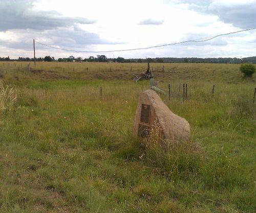
The monument commemorates the opening of Saumarez Ponds Bridge.
Location
| Address: | Dumaresq Road, Saumarez Ponds, 2350 |
|---|---|
| State: | NSW |
| Area: | AUS |
| GPS Coordinates: | Lat: -30.484591 Long: 151.57347 Note: GPS Coordinates are approximate. |
Details
| Monument Type: | Monument |
|---|---|
| Monument Theme: | Culture |
| Sub-Theme: | Community |
Dedication
| Actual Monument Dedication Date: | Saturday 29th March, 2003 |
|---|
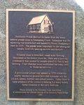
Saumarez Ponds derived its name from the many natural ponds close to Dumaresq Creek. Saumarez was the squatting run established and named by Henry Dumaresq`s men in 1835. The ponds were important for the aboriginal people, bird life, passing drovers and farmers.
Situated close to Armidale, small scale farming flourished in the district from the 1860`s and a thriving community was created by people linked by family and farming. Four churches were established but today only St. Nicholas survives.
A provisional school was opened in 1870 whilst the nearby recreation ground provided a popular site for cricket, tennis, football and school picnics. Today there is little evidence of the intensive farming but many hobby farms continue the early tradition.
Plaque donated by the Dumaresq Local Area Group to commemorate the official opening of the Saumarez Ponds Bridge
2003
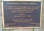
Plaque :
Saumarez Ponds Bridge
The construction of this bridge was a joint project of Armidale Dumaresq Council and Uralla Shire Council and was funded under the Roads to Recovery Programme.
Opened on Saturday 29 March, 2003 by the Hon. Tony Windsor, MP Member for New England.
Clr Brian Chetwynd Mayor Armidale Dumaresq Council
Clr Brian Elchorn Mayor Uralla Shire Council


