Allan Cunningham Print Page 
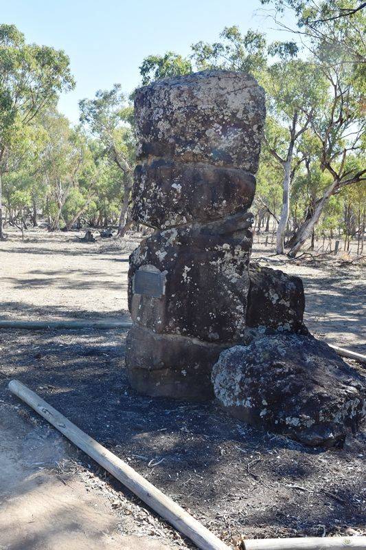
The obelisk commemorates explorer Allan Cunningham who crossed the Manilla River on the 17th May 1827 close to the site, and originally called it Buddle`s River.
Cunningham's longest, and perhaps most important, journey lasted from 20 January to late August 1827: from the Hunter valley he travelled northward crossing the Peel and Dumaresq Rivers and entered the Darling Downs before returning to the Hunter valley and Bathurst. While in the Darling Downs he found a gap in the ranges, now called Spicers Gap, which he thought would give access from Moreton Bay to the downs, whose fine grazing country he regarded as of major importance.
Location
| Address: | Trevallyn Road, 5 kilometres west of Barraba, Barraba, 2347 |
|---|---|
| State: | NSW |
| Area: | AUS |
| GPS Coordinates: | Lat: -30.375026 Long: 150.547103 Note: GPS Coordinates are approximate. |
Details
| Monument Type: | Monument |
|---|---|
| Monument Theme: | People |
| Sub-Theme: | Exploration |
| Actual Event Start Date: | 17-May-1827 |
| Actual Event End Date: | 17-May-1827 |
| Monument Manufacturer: | Nandewar Historical Society |
Dedication
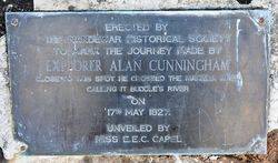
Erected by the Nandewar Historical Society
To mark the journey made by explorer Alan Cunningham
Close to this spot he crossed the Manilla River calling it Buddle`s River on 17th May 1827.
Unveiled by Miss E. E. C. Capel


