www.monumentaustralia.org.au
James WarnerPrint Page 
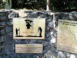
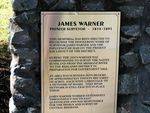
A monument commemorates pioneer surveyor, James Warner.
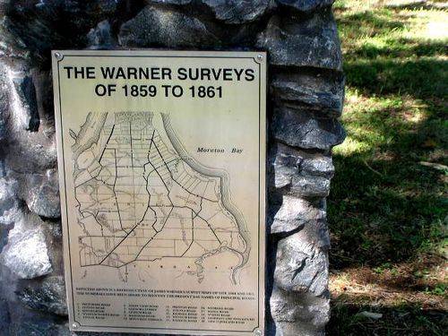
Warner surveyed towns and rural selections near Brisbane. In 1846 he was sent to trace the River Boyne from its source and to mark latitude 26 degrees, the southern boundary of the short-lived colony of North Australia, centred on Port Curtis. In January 1861 Warner produced, for sale, a large coloured map of Brisbane, which he exhibited at the Town Hall. It ran to a second edition in 1871. Upon the formation of the Queensland Institute of Surveyors in 1875, he was its first secretary and treasurer.
Location
| Address: | Tingal Road, Wynnum, 4178 |
|---|---|
| State: | QLD |
| Area: | AUS |
| GPS Coordinates: | Lat: -27.441944 Long: 153.169167 Note: GPS Coordinates are approximate. |
Details
| Monument Type: | Monument |
|---|---|
| Monument Theme: | People |
| Sub-Theme: | Government - Colonial |
| Link: | http://adbonline.anu.edu.au/adbonli… |
Dedication
| Actual Monument Dedication Date: | Saturday 23rd November, 1996 |
|---|
Front Inscription
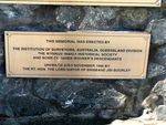
This Memorial Was Erected By
The Institution Of Surveyors, Australia, Queensland Division
The Wynnum-Manly Historical Society
And Some Of James Warner`s Descendants
Unveiled 23rd November 1996 By
The Rt. Hon. The Lord Mayor Of Brisbane Jim Soorley
Source: MA,ADBThis Memorial Was Erected By
The Institution Of Surveyors, Australia, Queensland Division
The Wynnum-Manly Historical Society
And Some Of James Warner`s Descendants
Unveiled 23rd November 1996 By
The Rt. Hon. The Lord Mayor Of Brisbane Jim Soorley
Monument details supplied by Monument Australia - www.monumentaustralia.org.au


